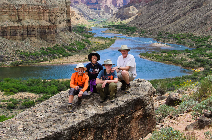
Our family on a side hike during our 2015 river trip down the Colorado through the Grand Canyon.

Our family on a side hike during our 2015 river trip down the Colorado through the Grand Canyon. |
|---|
|
On February 26, 2014 while Bob was going through e-mails in the waiting room of the local tire shop, an e-mail popped up from the Grand Canyon National Park River Permits office stating, "Thank you for submitting an application in the 2015 Grand Canyon National Park noncommercial river trip lottery. We are pleased to inform you that your lottery application was successful and we have scheduled a standard trip for you to launch from Lees Ferry on April 13, 2015."
At first it didn't really sink in, because ever since starting to apply for a permit back in 2003, we had received literally hundreds of other messages from the permit office saying just the opposite and he thought this was just one more of the same. This had been a long awaited and exciting e-mail, but now the reality began to sink in on all the work involved in putting a trip like this together. The first consideration was to think about who to ask to join us on this great adventure. The permit included space for 16, but coming up with folks who would be great to have along, who would want to go, could go and had the skills and endurance to deal with three weeks in the remote reaches of the Grand Canyon really helped narrow down the list. That said, we have a lot of really great friends and it wasn't long before we filled the permit with a number of them who were eager to join us on this once-in-a-lifetime adventure. Of course there were some changes between those who had originally signed on and those who could actually go, but when launch day rolled around we had filled the permit with a great team. Joining our family was a mixed group from Montana, Nevada, and even New Zealand. Some had river experience and some didn't, but all ended up being an addition to the mix of folks necessary for a successful and safe river trip. Those on the final roster included Kim, Konnor, and Kameron Kelsey, Mike and Christian Brunson, Earl Hall, Phil and Kathryn Spargo, Fred Olson, Debra March, Frank Nason, and Bill Belloni. Kim, and his boys Konnor and Kameron, joined Bob and Earl as boatmen for the five boats we took down the river. Bob had been on a number of river trips with the Kelsey's and Earl so having them on the team was a given. Bob also required his best friend Mike Brunson come along. Mike, gladly accepted not only because he would get to go on the trip, but also because he would get to share the adventure with his 10-year old son Christian. Mike and Bob have shared many big adventures together so there was never any question of his value to the trip. Debra March, Frank Nason, and the Spargo's are also dear friends from Nevada that have joined us on many of our Outdoor Adventures over the years. There attitudes, experience, generosity, and a whole host of other attributes made them a great addition to the trip. We had never met Fred or Bill prior to the trip, but both came highly recommended. Fred is a retired medical doctor from Montana who has joined Kim and Earl on a number of other river trips, and Bill is a long-time friend of Mike Brunson's. In all, we ended up with a great group to share our 2015 river trip with. Below are a few highlights and pictures of our adventure in the Grand Canyon. Join us as we head downstream. Your friends, Bob, Lisa, Hannah, and Caleb. P.S. Before you begin, check out this great video trailer Caleb put together. |
|
|---|---|
Preparing and PackingPay attention; once you launch, what you have is what you have for the next three weeks. |
|
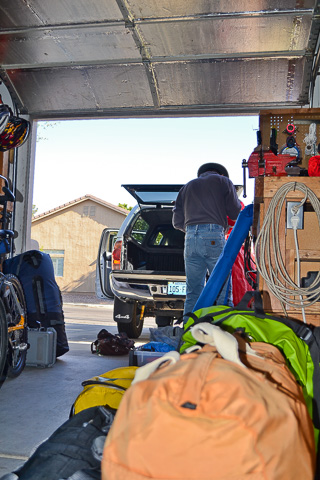
Bob in our garage putting together the mountain of gear we would need for our upcoming river trip. |
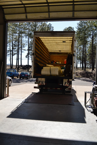
Professional River Outfitters (PRO), based out of Flagstaff Arizona, was the outfitter we chose to provide boats, gear and food for our trip. PRO is a very professional company with years of experience assisting private groups like ours. PRO supplied us with four fully rigged rafts (the Kelsey's brought one of their own) and all the gear and food we would need for the trip. Organizing hearty meals for a group of sixteen and keeping perishable foods from spoiling is a big job. We worked with PRO ahead of time planning specialized menus for our group and they did an awesome job packing and organizing it for us. Their coolers even have a special patented ice freezing process to ensure our food stayed cold for three weeks. This is an image of PRO's truck being loaded at their warehouse with the pile of food and gear customized for our trip. |
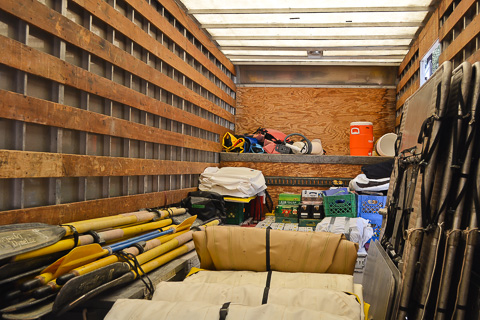
Bundled oars, deflated and rolled rafts, and boat frames loaded and ready for the put-in. |
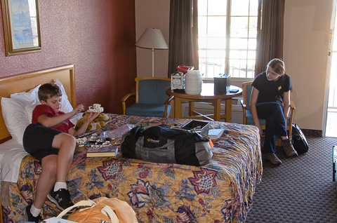
Caleb and Hannah in our Flagstaff motel room. This would be the last night for three weeks where we would get to sleep in a real bed and take showers where we wouldn't have to heat the water in a bucket over the campfire first. |
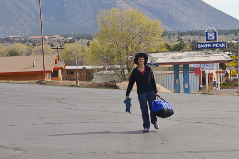
Lisa, gear in hand, is all smiles as she heads to the shuttle van. This would be the first of many bags she would haul over the next 21 days. |
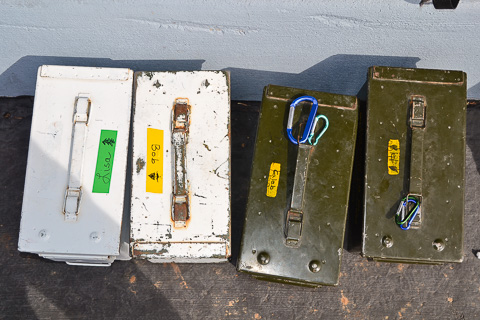
Each person on the trip had an ammo can to store their personal items in. Ammo cans work great because they are sturdy and most importantly, waterproof. Here are our each of our family's personally labeled cans. |
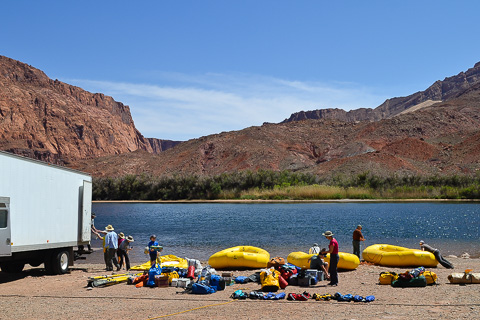
April 12th, the day before launch day rigging boats. The process begins by first inflating the rafts, then strapping down the rowing frames and loading dry boxes and coolers; it's a lot of work! |
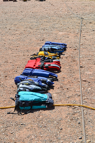
PFD's (Personal Flotation Devices) are an essential and required item on a Colorado river trip. No one wants a fine, but more importantly, they will save your life if you get dumped into the cold waters of the Colorado. |

This is panorama of Lee's Ferry while rigging the boats. |
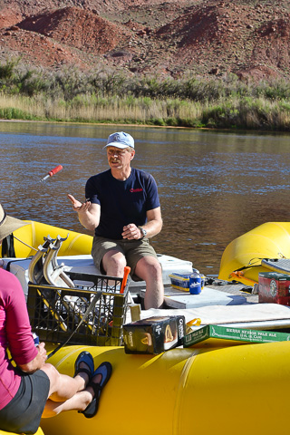
Bob getting his boat set up. Each boatman is captain of their own raft and responsible for everything on board. All jobs on a rafting expedition are important, but the boatman's is one of the most important. Hannah captured this picture of a screwdriver being tossed to Bob so he can clamp down the foot stand that goes in the boatman's well. The foot stand is important for the boatman to get all the leverage he can when pulling on the oars through the big rapids that lie ahead. |
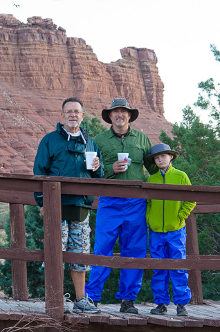
Bill Belloni, and Mike and Christian Brunson grab some coffee before the launch. |
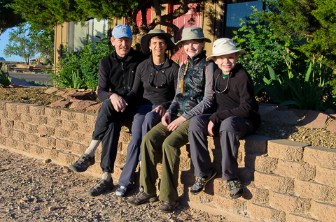
The Potts family (Bob, Lisa, Hannah and Caleb) pose in front of our motel room at Lee's Ferry on the morning of April 12th, 2015. |
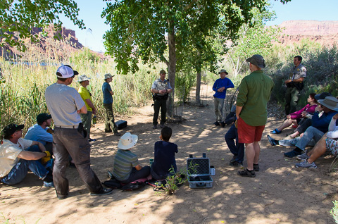
April 13th, 2015 - Launch Day. Before our launch a mandatory Park Service briefing is required. Our group listened while a Park Ranger elaborates on required emergency procedures and some of the potential dangers involved in a private raft trip. |
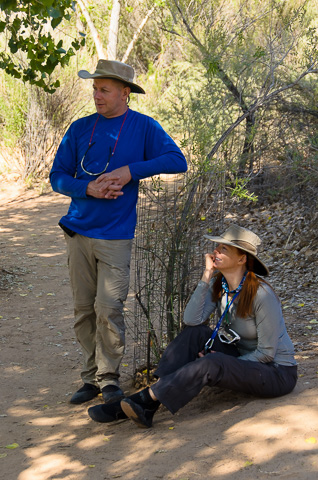
Phil and Kathryn Spargo. This great couple had just gotten married in New Zealand. They considered this trip a part of their extended honeymoon. |
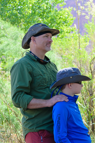
Mike and Christian Brunson. Christian was the youngest on the trip at 10 years old. |
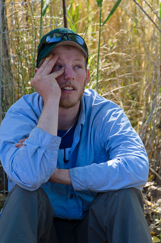
Kameron Kelsey had heard this briefing before and was ready to get on the river. |
Finally on the river. We have just launched and are headed to our first camp at Badger Creek (River Mile 8). |
|
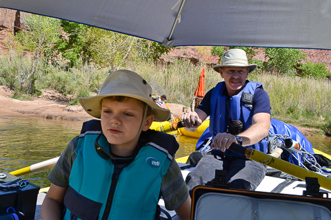
Caleb was glad Dad brought the umbrella as we launch on a warm and sunny day. Bob, our family's boatman, is at the oars. |
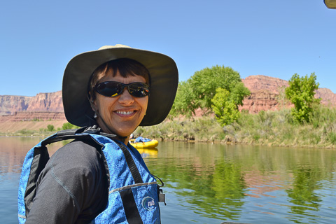
Lisa is happy to on the river after all the months of preparation. She, along with Kathryn Spargo and Hannah, were in charge of food on the trip. |
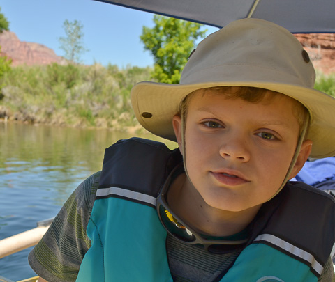
Our son Caleb enjoying his first river day. At 11 years old this is Caleb's second trip down the Grand Canyon. His first time was in Mom's tummy when Lisa went on this trip in 2003. |
|
April 13 -- Badger Camp -- River Mile 8 |
|
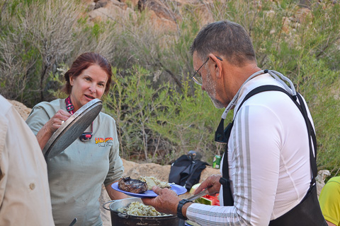
Before the trip began we split our group of 16 into four cooking crews. The crews rotated with each preparing an evening and a morning meal, and the previous days crew doing the dishes. Splitting up kitchen duties helped spread the responsibilities. Debra March, Mike Brunson, Kameron Kelsey and Caleb had the first shift. Here Debra is dishing up a meal of mashed potato's and perfectly grilled rib-eye steaks. |
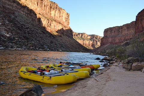
An evening at Badger Camp. |
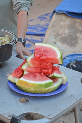
After a hot day on the river, watermelon sure tasted good. |
|
|
After leaving Badger Camp on the morning of the 14th, we had a number of rapids to run including the first of the big ones, House Rock rapid, at river mile 17. The Grand Canyon uses a unique river rating scale. The rapids are technically rated 1-10 to account for the wide variety of rapids and river conditions found in the Canyon. House Rock rapid is rated 7 because of the big holes on river left with the challenge of staying off the rocks on river right. This was especially the case for our trip as we had low flows and there was little margin between the holes and the rocks. |
|
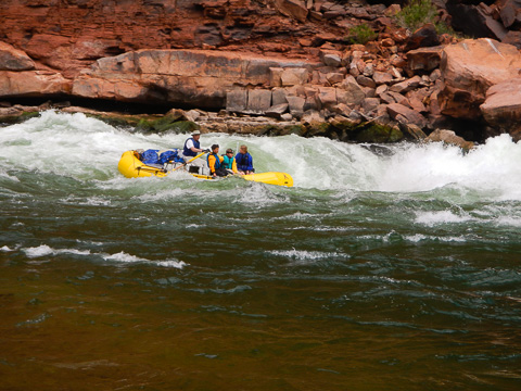
House Rock Rapid is named for the house-sized rock in the rapid's center, this was a taste of the big water the Grand Canyon is famous for. We pulled in above it where Bob and the other boatmen walked down along the bank to find the safest route through. Sometimes the boatman (or the passengers themselves) decide that some of the passengers should walk around the rapid for safety. Bob returned to our family's boat after scouting House Rock and said, "Suit up, we're all going through". Nervously donning our spray suits, we headed down the tongue of the river and into some amazing whitewater. After a scary and amazing ride we were wet, yet exhilarated -- and this was only the beginning! |
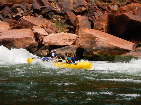
Our family with Bob at the oars on an exciting ride through House Rock rapid. |
April 14 -- North Canyon -- River Mile 20 |
|
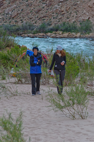
Lisa and Kathryn enjoying a walk in the beach sand at our second camp at North Canyon. North Canyon is a popular stop for river runners. We are in the section of the Grand Canyon known as Marble Canyon. In this section of the river, the geology is amazing as the Hermit Shale makes its appearance. Many species of plant fossils have been identified in this shale. |
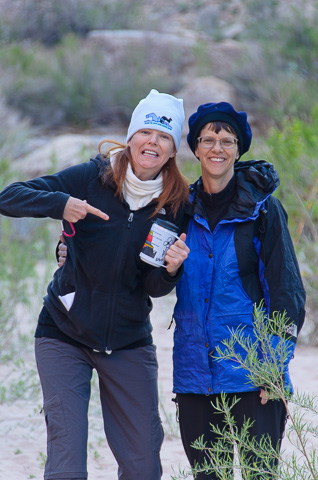
Coffee is a very important part of the trip - as Kathryn points out. Kathryn earned the title of "Food Queen" on this trip as she very ably took on the job as the food organizing guru. |
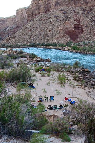
Our camp with fire circle in the center. Across the river the darker band of red is the Hermit Shale formation. We learned a lot about the Grand Canyon geology as we floated on this beautiful river as it cuts its way into the earth. Our commemorative coffee cups, compliments of PRO, even had the Grand Canyon's geological layers printed on them. |
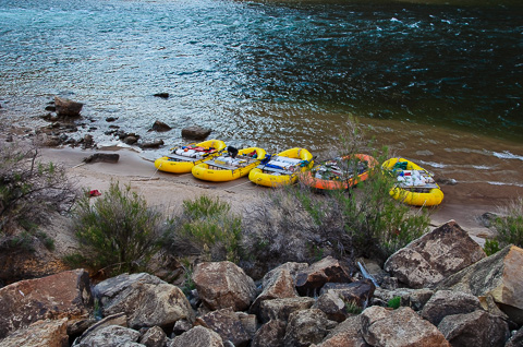
Our five boats pulled up on the beach. The four yellow rafts are from PRO and the orange Chubasco boat was the Kelsey's. This ended up being the last ride for the Chubasco as after 30+ years, it was worn out. |
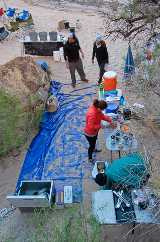
The kitchen set up from above. |
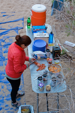
Debra chopping tomatoes in prep for a meal. Our meals were amazing, often bordering on gourmet, and the desserts were also fabulous. A great thing about river rafting is it combines the best of car camping and backpacking. |
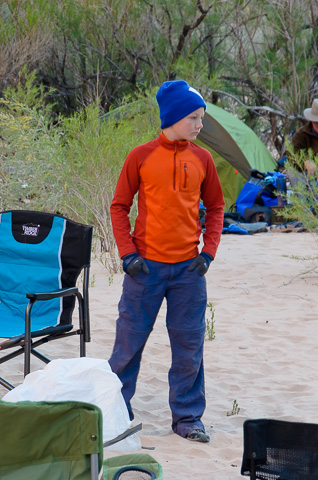
Christian Brunson |
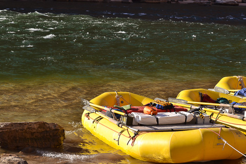
Hannah was our official trip photographer. Though lots of photos were taken by everyone (the total numbered in the thousands) some of her shots really capture the essence of the little things that made this trip great. This photo of hers really portrays river serenity. |
April 15 -- South Canyon -- River Mile 32 |
|
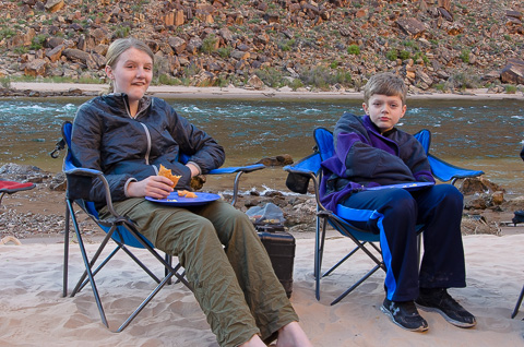
Hannah and Caleb looking a little sleepy as they enjoy a breakfast burrito around the fire. |
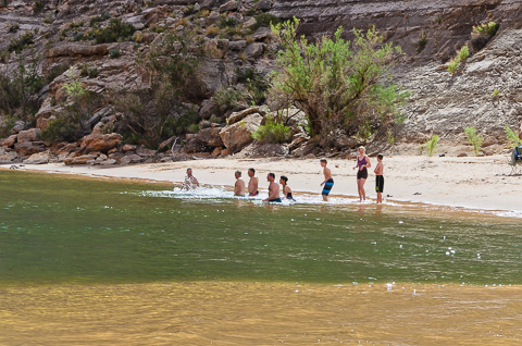
As it was a hot day some of our group braved the cold waters of the Colorado in what they dubbed the " Polar Bear Plunge". |
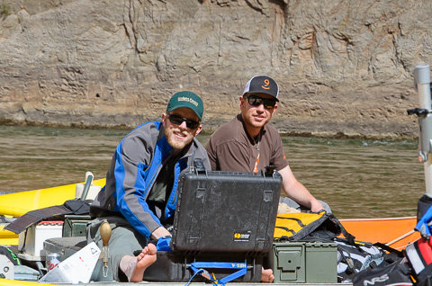
Kameron and Konnor Kelsey. These brothers have followed in their dad's footsteps by becoming accomplished boatmen themselves. |
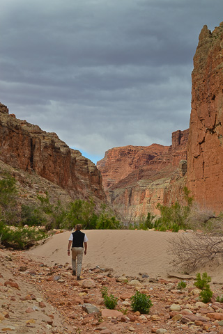
Bob enjoys a walk in this place where you are always surrounded by beauty. |
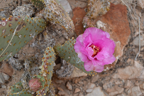
A beavertail cactus in bloom. |
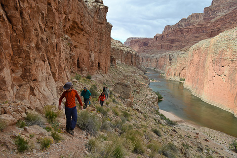
A hike above the river. The dominant rock formation is now Redwall Limestone, one of the main rock groups of the Grand Canyon. The layer is rich in fossils and was formed 1,000 feet below the surface of the ocean. This is the "pinkish" formation seen in the cliff across the river. |
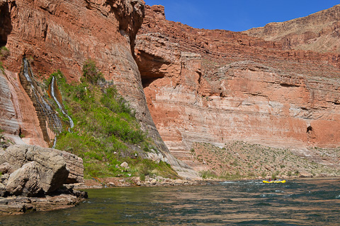
Vasey's Paradise at river mile 32. This amazing spring cascades out of the Redwall limestone and, although beautiful, much of the "green" around it is poison ivy. John Wesley Powell named this spring in 1869 for his friend and botanist, George W. Vasey. |
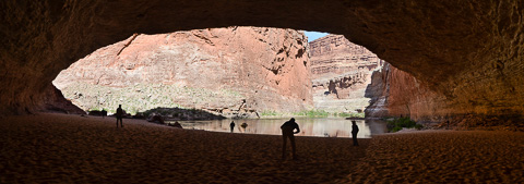
Redwall Cavern, just past river mile 33, is a huge natural amphitheater formed in the Redwall sandstone. We stopped here to stretch our legs and toss a football around. |
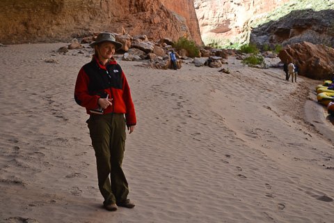
Hannah in Redwall Cavern You can see Hannah's journal tucked under her arm. Years from now she and others will enjoy how she documented this life-changing trip and the great poems she wrote while on the journey. Click here for a couple of Hannah's favorite poems. |
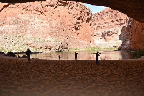
Tossing the football around in Redwall Cavern. |
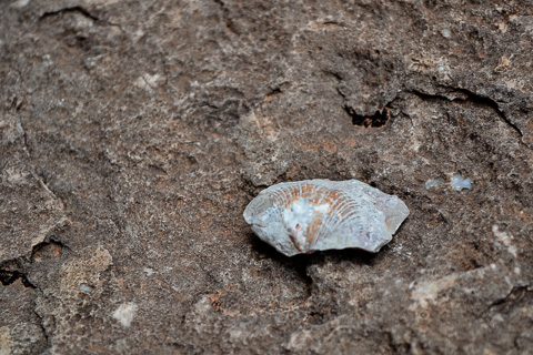
There is lots to see in this ancient section of the canyon. Nautiloid Creek is a popular stop where a short hike and a climb up a 75 foot limestone cliff brings you into Nautiloid Canyon (Mile 35). It took a bit of hunting, but our group did find some interesting fossils. Here is one of a shell. |
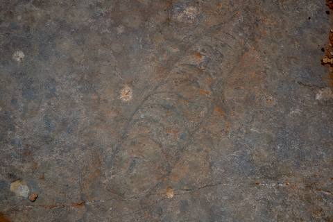
We also found this fossil of an ancient Nautiloid, a giant prawn-type creature, while in Nautiloid Canyon. Pouring water on the rock helped the fossil outline to stand out. |
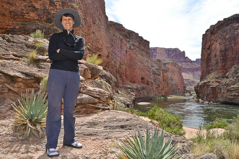
Lisa along the Colorado. |
|
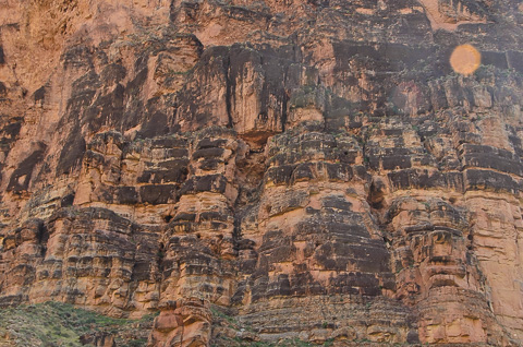
Way up there in the rocks is a bridge built by the Anasazi many years ago. This bridge is reported to be part of a prehistoric cross canyon trail. There are many cross canyon routes in the Grand Canyon. |
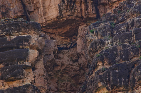
Zoomed in on the Anasazi Bridge located just below river mile 43. The building ability and bravery of these ancient peoples in navigating the canyon is truly amazing. |
April 16 -- President Harding Camp -- River Mile 44 |
|
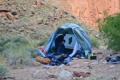
Lisa in our tent at President Harding camp. This camp is at the top of the eddy just below President Harding rapid. This eddy is know for catching driftwood and other bits of this and that. In the past this eddy has also caught at least two people known to have drowned in the river. In 1890 a survey crew found the remains of a skeleton in the rapid. You can see the grave where they buried him just a short walk from the camp. This camp for us was very rainy all night and in the morning there was even a little snow on top the canyon rim. |
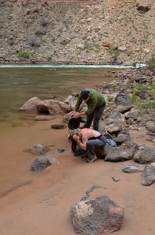
After a couple of days on the river, it's about time to do a little bathing. Here Mike helps Debra wash her hair. |
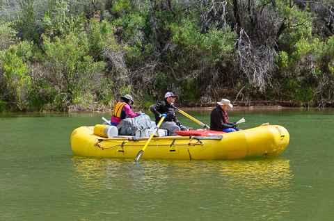
After leaving President Harding camp the morning of April 17th we had about 10 miles of relatively flat water to our next big adventure, the hike to the Nankoweap Granaries used many years ago by the Anasazi. |
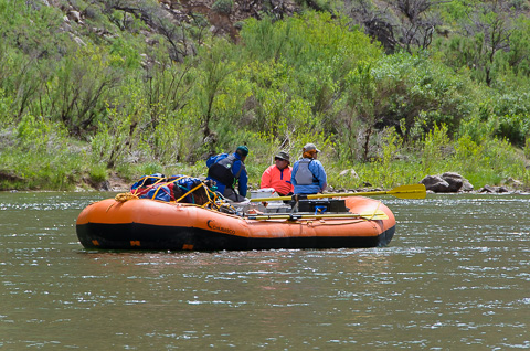
The canyon is not all rapids - a calm section. |
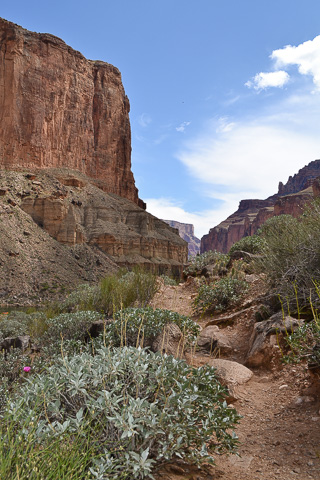
The trail leading to the Nankoweap Granaries. The granaries were used a thousand years ago by the local indians to store the grain they grew in the river delta to keep it dry and safe for when they would need it in the winter months. The day was a bit warm and climbing the trail made you appreciate the indians who regularly climbed this route with a load of grain on their back. |
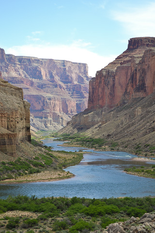
View of the Colorado from the Nankoweap Granary trail. |
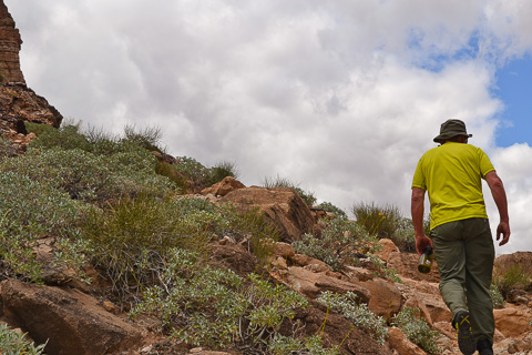
Our friend, Frank Nason hiking up the trail. |
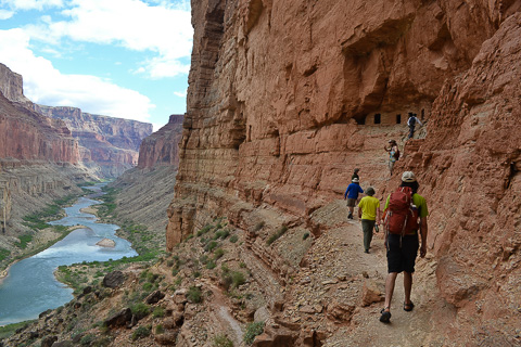
The surreal colors of the canyon stretching below us as we near the Nankoweap Granaries. |
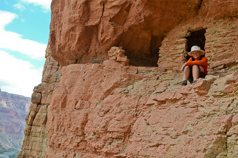
Our son Caleb |
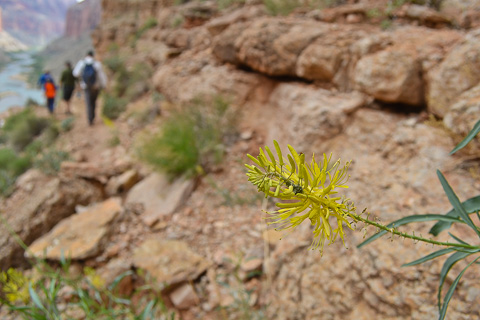
Plants and animals abound in the canyon. Here a yellow beeplant clings to the canyon cliffs. |
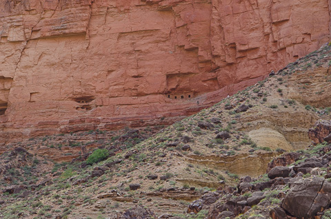
The granaries surrounded by the many colors of the canyon. |
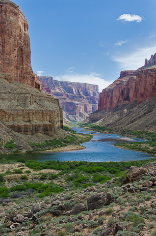
The awe-inspiring view from the top. |
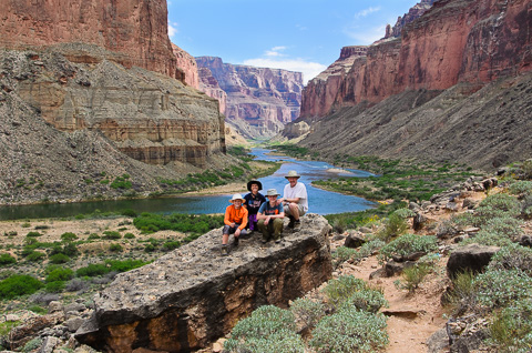
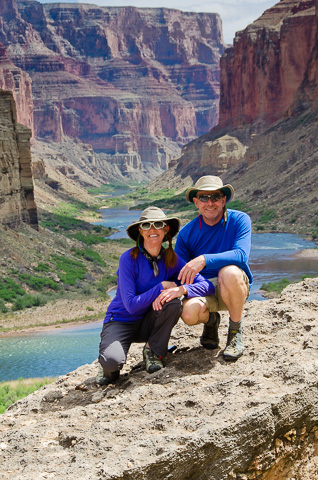
Our family in the Grand Canyon |
Phil and Kathyrn Spargo |
It's hard not to take too many photos of a place like this! |
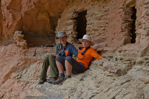
Our kids - the adventurers. |
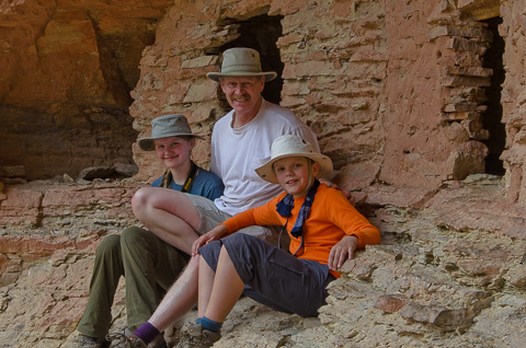
Hannah and Caleb with their Dad. |
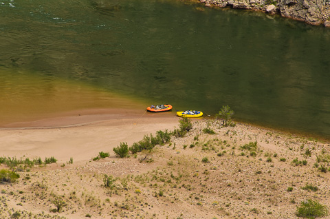
Looking down at our boats from the trail that leads up to the Nankoweap Granaries. There are only two because some of our group chose not to make the hike and continued on to set up our next camp. |
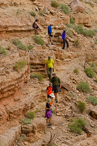
Coming down the trail. |
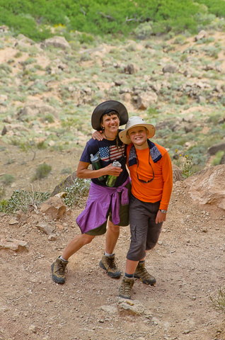
Mom and son enjoying a great time together. |
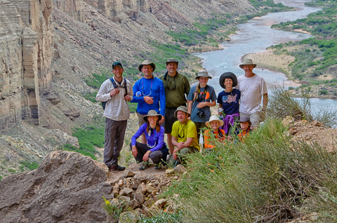
The would-be "Grain Haulers", yeah right. |
|
April 17 -- Kwagunt Camp -- River Mile 56.5 |
|
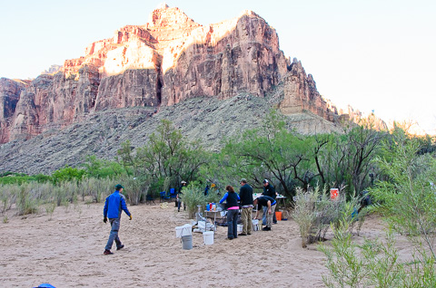
Kwagunt Camp is at the foot of Kwagunt Rapid. It is a popular, large camp so we had room to spread out. This picture shows the kitchen set up. The buckets in the middle of the photo are for the hand washing system which uses a foot pump to bring water up through a spigot and into a gray water bucket (appropriately the gray one in the picture). Hand washing is so important on a trip like this. Passing illness from one person to the next is a serious concern on these trips. |
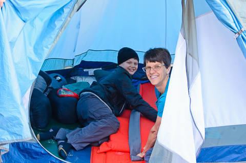
Mom and son performing the daily ritual of setting up camp. We were in a different camp almost every day, so we got really good at setting up and taking down our tent site. |
|
After leaving the Kwagunt Camp the morning of April 18th we had a beautiful float down the lower reaches of Marble Canyon to the confluence with the Little Colorado and some fun time playing in the beautiful, turquoise water. It get's its distinctive coloring because the calcium-carbonate and copper-sulfate minerals in area. |
|
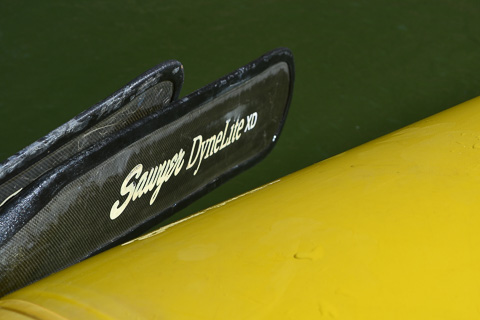
A shot Hannah took of our boat oars. |
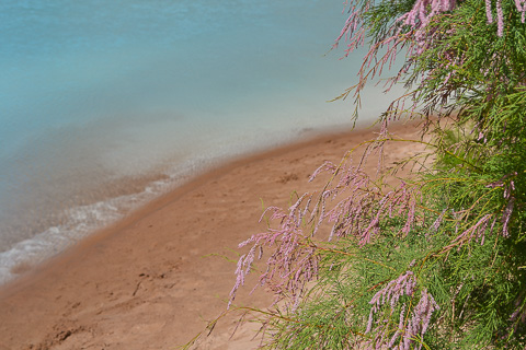
Tamarisk blooms at the Little Colorado River. |
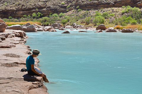
Lisa's favorite spot. |
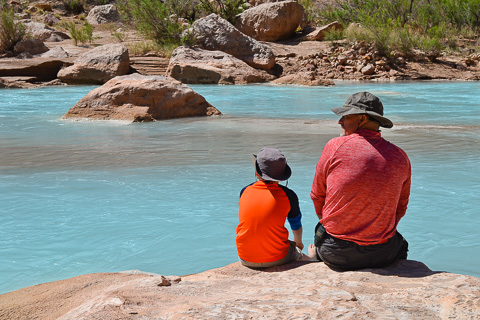
Mike Brunson and his son enjoying the amazing blue water. |
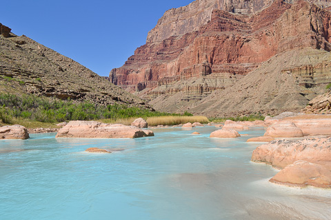
The Little Colorado river is revered by the Navajo and Hopi indian tribes and you can see why. |
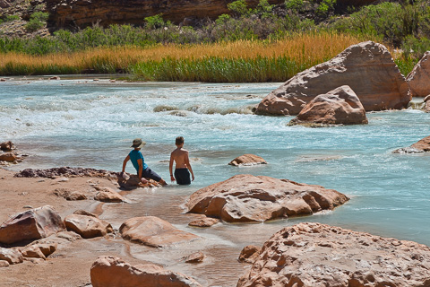
Lisa and Caleb getting rejuvenated in the mineral rich waters. The color of the water, which only exists when not in flood stage, is created by minerals dissolved from the surrounding rocks. |
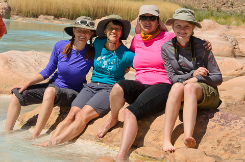
The girls having a spa day. |
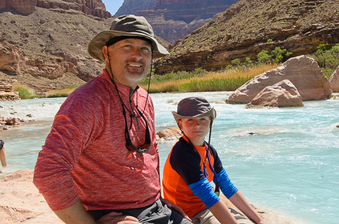
Mike and Christian Brunson |
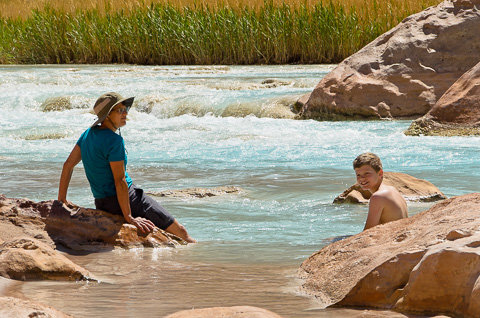
This is the life! The water is also warmer than the main Colorado so bathing was definitely an option. |
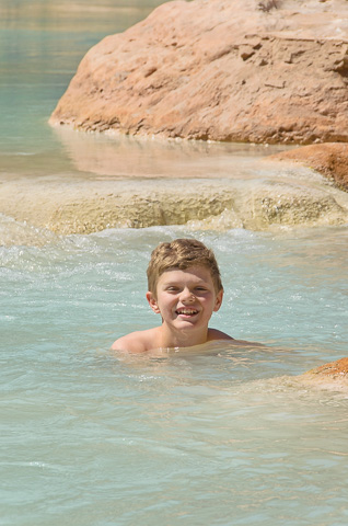
Caleb loves swimming. |
April 18 -- Upper Unkar Camp -- River Mile 72.5 |
|
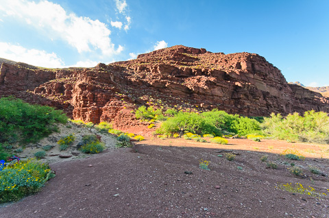
We arrived in Unkar Camp fairly early in the day, so we had time to do some laundry and hike in this amazing part of the canyon. The Unkar Delta offers great hiking to extensive Puebloan dwellings. Following the path from camp you hike through yellow blooming brittlebush and climb a rise to a plateau filled with the ruins of ancient Pueblos. While wandering through the ruins we found many pieces of broken pottery. Visitors are encouraged to pick up the pottery pieces in this open air museum, but also to return them to the exact spot they found them so others can enjoy them as well. The only regret we had while visiting this fascinating place was that our friend Alex Heindl, who is very knowledgeable and loves this area could not be here with us. Having him along on our 2003 trip was great and we really missed him. |
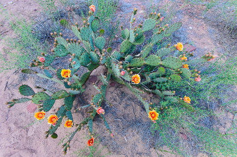
A blooming prickly pear cactus. Great to look at, but like many things in the canyon, you enjoy them from a distance. |
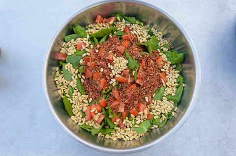
An amazing salad prepared by our kitchen crew of the 18th, Mike Brunson and Debra March. |
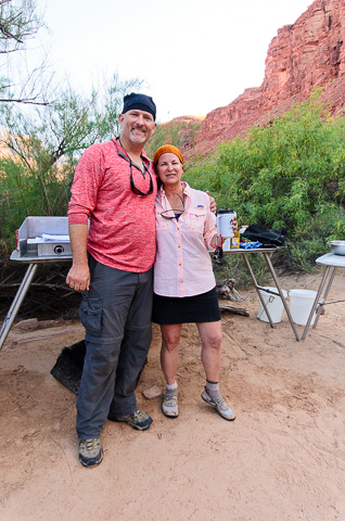
Mike and Debra - at the helm for another great meal. |
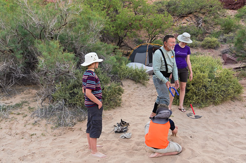
Caleb, Christian, Bill, and Hannah enjoying a game of horseshoes. |
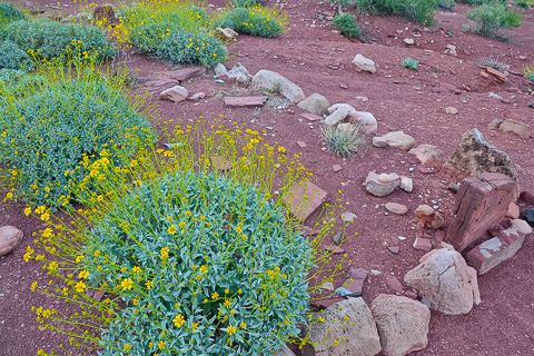
These stones are the remains of an ancient Pueblo dwelling we saw while hiking around the ruins on the Unkar delta. |
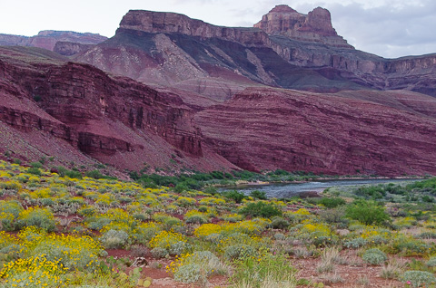
The Unkar Delta with yellow with brittlebush. You can see why it was a choice location for ancient peoples. |
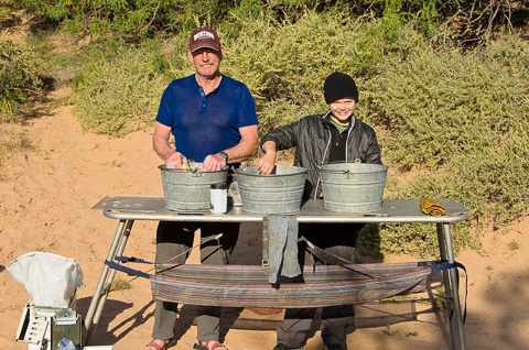
Kim and Caleb on the dishwashing brigade. |
|
Our plan for April 19th was a fairly short day of 10 miles to Grapevine camp. On the way, however, we had a number of big rapids to deal with including Hance (8) and Sockdolager (7). |
|
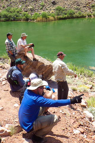
Just below river mile 77 debris from Red Canyon dumps into the Colorado and forms Hance Rapid, one of the largest on the river. This rapid had all of us a bit concerned because it had changed after a big flash flood in 2012 and none of us had run it since then. Hance is a boulder field with a lot of big rocks to get hung on and holes to flip in. Here we are trying to figure out the best way through the maze. |
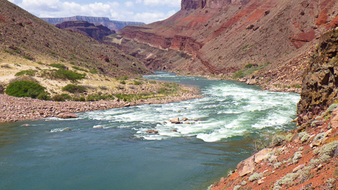
Hance Rapid |
April 19 -- Grapevine Camp -- River Mile 82 |
|
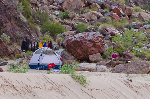
Grapevine Camp is across the river from where Vishnu Creek enters the Colorado. Beginning here the oldest of the Grand Canyon rocks starts showing itself, the Vishnu Schist. Vishnu Schist has a complex geological history. Imagine taking some ancient sea sediments, throwing in some lava extrusions, mixing it up, and melting it deep within the earth. The result is a very hard, very dark rock shot through with pink granite. Of all the rocks in the canyon this was Lisa's favorite. Running your hand along the black, fantastically fluted edges you could feel the oldness of it - like you were touching the "bones of the earth". |
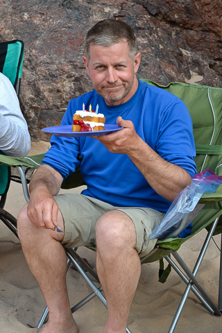
Phil Spargo celebrating his 50th birthday at Grapevine Camp with cake, cherries, and whipped cream! |
|
After leaving the Grapevine camp the morning of April 20th we had a short, six mile row to Phantom Ranch to pick up souvenirs, make a few calls, and fill our water jugs. On the way to Phantom we had another big rapid to run, Grapevine, but everything went well and we were soon out and touring Phantom Ranch. |
|
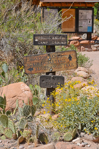
Phantom Ranch has a campground, lodge, store, flush toilets, water, and a bit of civilization. Best of all are the stamped postcards you can mail stating; "Mailed by Mule from the Bottom of the Grand Canyon". Mules are the only cargo transportation between Phantom Ranch and the Canyon Rim. |
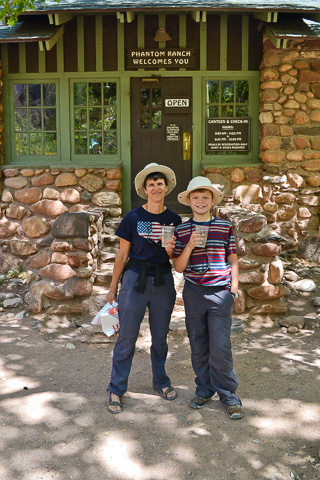
Getting a few treats at the Phantom Ranch store. |
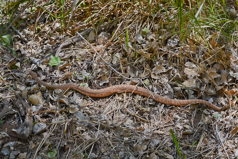
While hiking the trail back to the boats, we spotted this Kaibab Pink Rattlesnake by the trail. It was one of the first snakes we saw on the trip. |
|
|
After leaving Phantom Ranch we got ready for the highest concentration of big rapids we would deal with. In total we had 14 rapids to run before our next camp 16 miles downstream. These included Horn Creek, Granite, Hermit, and Crystal. All of these rapids are rated at level 8 on the 1 through 10 Grand Canyon rating system. That said, the consequences of missing the right line are quite a bit different from one rapid to the other which has the same rating. |
|
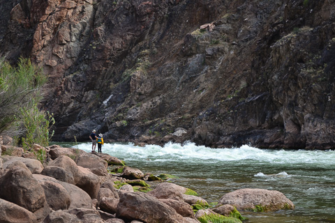
Dad and son scouting one of the two really big Grand Canyon rapids -- Crystal Rapid. The other is Lava Falls rapid; still another 80 miles downstream. |
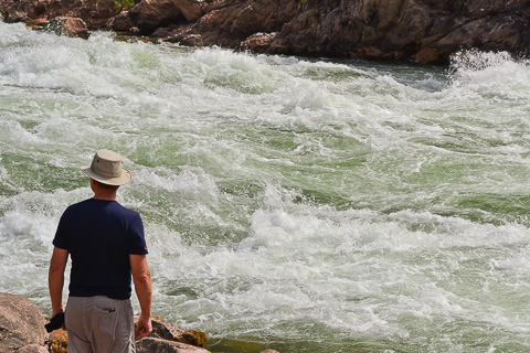
Bob thinking, "I don't want to get into that big stuff on river left." |
|
Check out this video that Katherine Spargo took of our run through Crystal Rapid. |
|
April 20 -- Emerald Camp -- River Mile 104 |
|
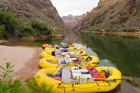
Our boats tied up for the night at Emerald Camp. |
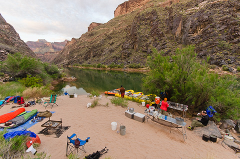
A view of our camp set up. The kitchen is on the right and on the left are Konnor and Kameron still in their sleeping bags next to the fire pit. Sleeping under the stars was a great option when the weather was nice and offered a spectacular views before drifting off to sleep. |
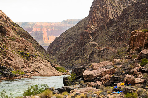
The view from our family's camp. |
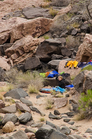
Hannah waking up after a good night's sleep in our camp among the rocks. |
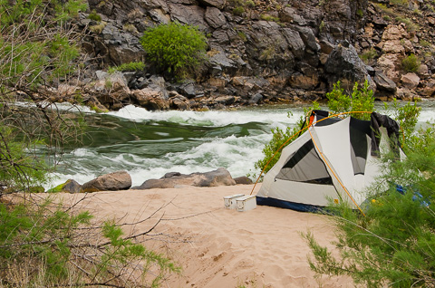
This idyllic setting is Mike and Christian Brunson's camp next to Emerald Rapid. Christian picked it out and we all thought it worthy of being featured on next years National Park's Pass! |
|
April 21st and 22nd -- Bass Camp -- River Mile 109 |
|
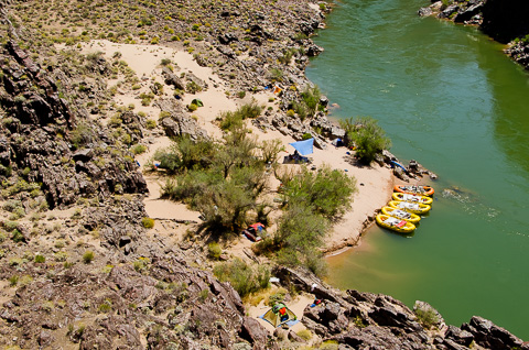
Our camp at Bass Camp from above. We spent a layover day here and had the chance to hike up Shinumo Creek to the original Bass Camp used by William Bass from 1908 to 1925 to ferry equipment and people across the river. |
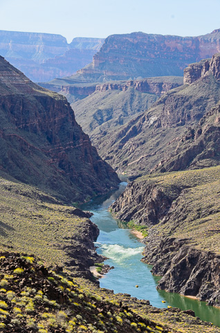
The view we had of Shinumo Rapid on our hike to William Bass' camp. |
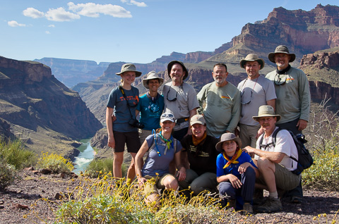
Our Bass Camp hiking group on a fairly warm day. |
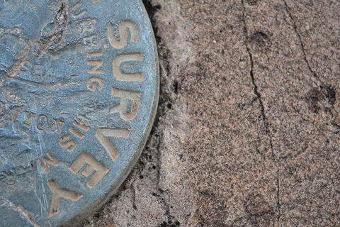
The survey marker near William Bass' camp about three miles up Shinumo creek from the river. |
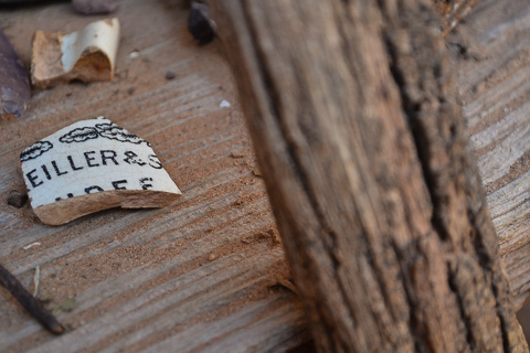
A close up of some of the remnants at William Bass' camp. |
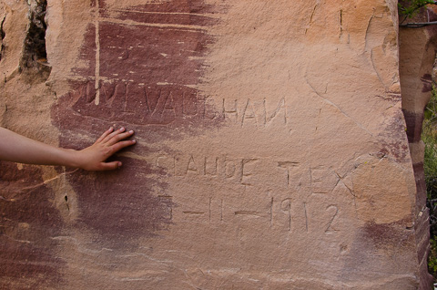
This is an inscription in the rock near the William Bass camp. You can see that the inscription dates from 1912. |
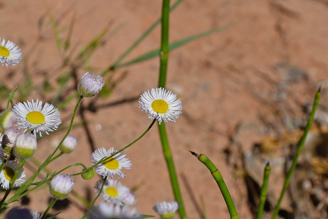
Flowers and horsetails now add a bright spot to this historical spot. |
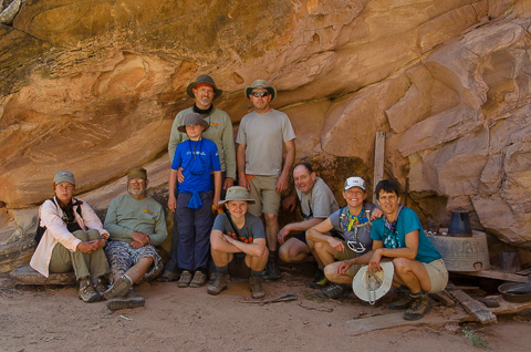
Our hiking group resting in the shade of the Bass Camp cook site. You can see some of the collected artifacts behind us. The Grand Canyon has many of these open air museums to enjoy. |
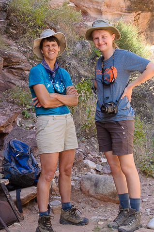
Lisa and Hannah enjoying a little shade. |
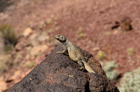
A western chuckwalla perched on a rock observes our group. |
|
After a wonderful two-day break at Bass Camp, we once again headed downstream on the morning of April 23rd for a fun day of moderate rapids and a great side trip up Elves Chasm. |
|
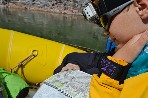
Caleb with his GoPro strapped on his head as he studies the river map and the upcoming rapids. Caleb filmed all the big rapids on our adventure with a GoPro loaned to him by our good friend Alex Heindl. When we returned Alex told Caleb he should keep the GoPro; Caleb was stunned and so thankful. Another example of how great and generous Alex is and how much we missed him on this trip. |
|
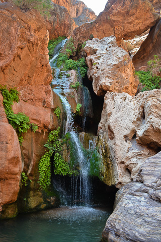
Elves Chasm is favorite stop for river runners. This jewel of the desert is only a quarter mile from the river and a really "cool" place to stop especially when it's hot. |
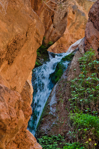
Elves is an amazing place and we spent a couple hours there jumping and swimming in the "cool" pools. |
April 23 -- Blacktail Canyon -- River Mile 120 |
|
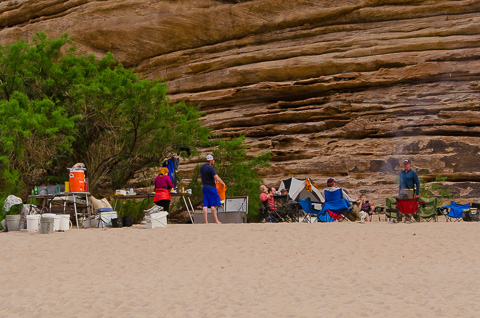
Our camp at Blacktail Canyon was great. |
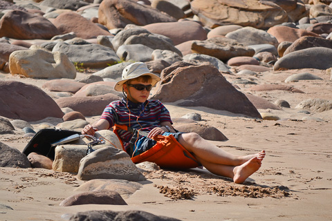
Caleb taking a rest and listening to music on the beach after helping set up camp. |
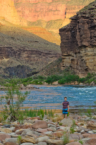
Caleb caught wandering around the beach near our camp at Blacktail. Our camp was actually called Opposite Blacktail, so we had to ferry across the river to make the short hike up Blacktail Canyon, a slot canyon in the Tapeats sandstone. In this canyon you can view the famous geological "Great Unconformity". This is where younger Tapeats sandstone rests directly on top of the much older Vishnu Schist with eons of geology in between. Geologists are not certain how this occurred, but here you can touch it with your hands. |
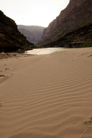
Sand was a continual companion on the Grand Canyon trip. We found it in our teeth, our socks, our tent, water bottles, everything. After emerging from the canyon, the group joked that it would take months to purge themselves and all their stuff. |
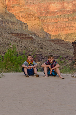
The youngest members of the trip, Christian and Caleb, playing and relaxing on the beach together. This trip is something they will always remember. |
|
|
Our goal on April 24th was to make it another dozen miles to the Stone Creek camp at river mile 133. There was another 10 or so rapids to run including Specter (6), Bedrock (7), and Deubendorff (7). Bedrock is particularly challenging, because of a rock the size of an apartment building in the middle of the river forces most of the flow through a narrow channel up against the cliff face on river left. The strategy is to go into the rapid and pull hard right to go around the safe side of Bedrock. The problem is, at least 80 percent of the river's flow wants to flush you down the wrong way, so if you don't go right and get it right, there's a really good chance you will get pulled into huge hydraulics and flip. All of us made it safely into the right channel except for Earl who, thankfully, made it safely through the wrong (left) run. |
|
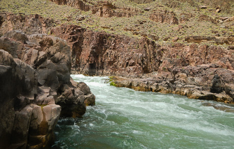
Looking up the "wrong" side of Bedrock rapid. |
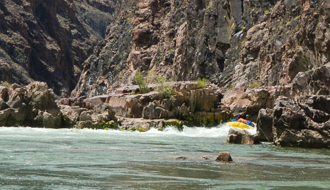
Earl coming safely through the "wrong" side of Bedrock rapid. |
|
Just a couple of miles below Bedrock rapid was Deubendorff rapid. Although rated the same as Bedrock, Deubendorff is more straight-forward and a fun ride. Check out the video that Caleb took with his GoPro while we bounced through Deubendorff. |
|
April 24 -- Stone Creek -- River Mile 132.5 |
|
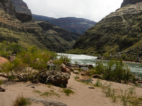
The view back upstream from our Stone Creek camp at Deubendorff rapid (7). |
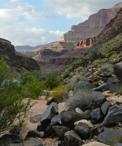
Stone Creek camp. The distinctive black rock in the foreground is Vishu Schist. This ancient formation dominates this section of the canyon. |
|
April 25th promised to be a great day with one of the best hikes in the Canyon. Our plan was to float three miles downstream where some of us planned to hike up Tapeats Creek to Thunder river. Those that weren't interested in hiking would continue on another four miles to Deer Creek for our second layover camp. The hike to Thunder River is a spectacular eight mile walk through the beautiful Tapeats creek drainage where Thunder River, the world's shortest river, gushes out of the red cliff face in a sparkling cascade of white water into Tapeats Creek. |
|
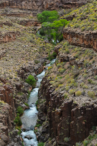
Tapeats Creek far below the hiking trail on the way to Thunder River. |
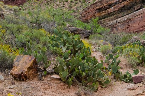
A big part of what made this trip so great was all the spectacular hikes down trails that weave their way through undisturbed and seldom visited areas. The variety in flora, fauna, and geology was really great. |
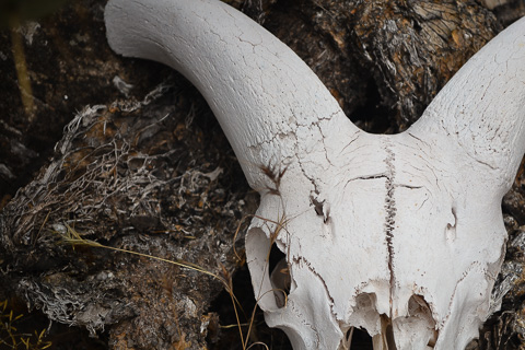
A close-up Hannah took of a bighorn sheep's skull lying along the trail to Thunder River. |
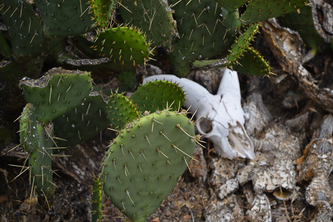
Characteristic of the canyon are scenes of death and life in the same place. |
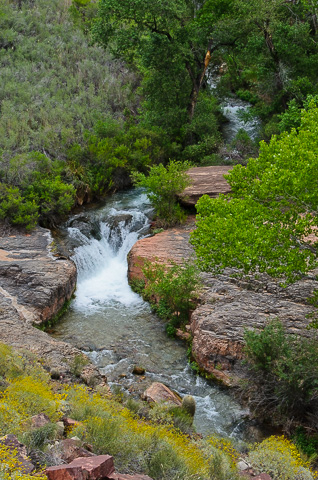
Beautiful Tapeats creek. |
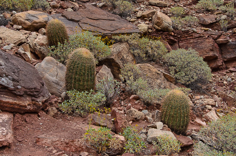
Throughout the Grand Canyon there are numerous species of cacti including the famous barrel cactus pictured here. |
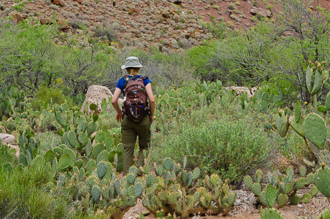
Hannah hiking through a large cactus field. Even though we were constantly around the prickly plants, no one on the entire trip had a mishap with our prickly neighbors. |
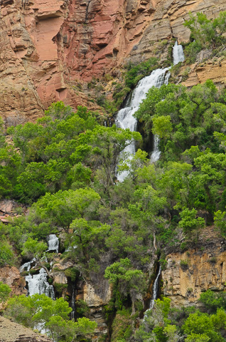
The famous "shortest river in the world", Thunder river, gushes from the red sandstone cliffs and tumbles a short two miles before merging with Tapeats creek. It is an impressive sight. |
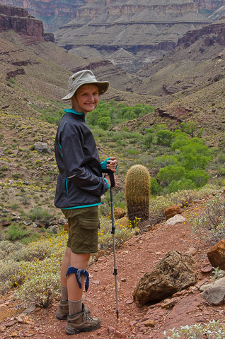
Hannah, our hiking girl. This was one of Hannah's favorite days of the trip. |
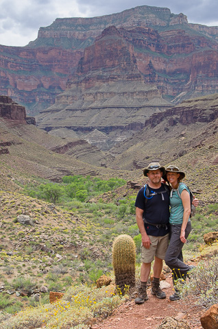
Phil and Kathryn Spargo. This couple was a super addition to our group. Phil was our sanitation engineer, in charge of setup and takedown of our toilet (or "groover" as they call it in the rafting world) while Kathryn was in charge of all our food stores. Their upbeat attitude was a huge asset on our expedition. |
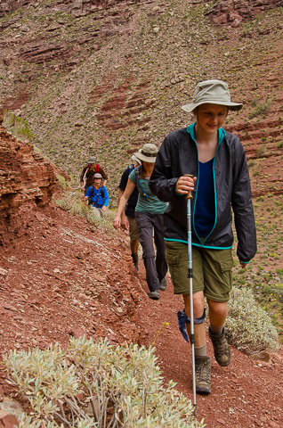
Hannah leading the way the way back from Thunder River. |
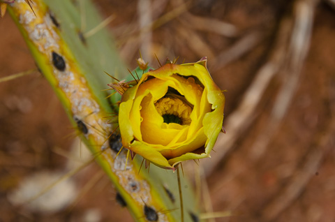
A prickly pear cactus in bloom. |
April 25th and 26th -- Deer Creek Camp -- River Mile 137 |
|
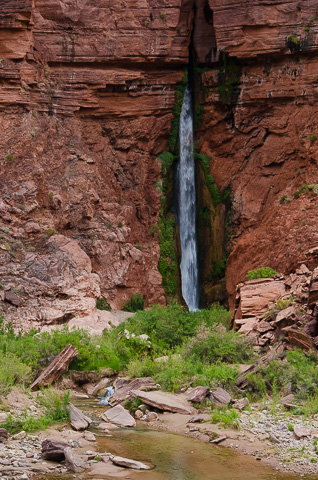
Deer Creek Falls as it crashes down before joining the main river. |
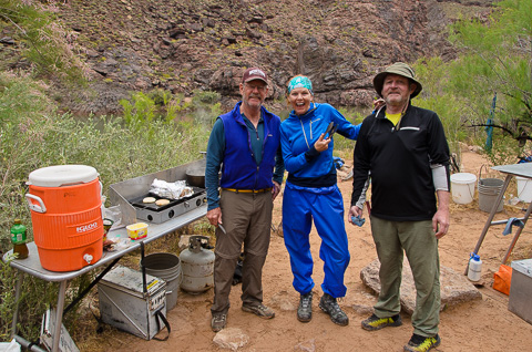
Kim, Kathyrn, and Frank joking around in the kitchen. |
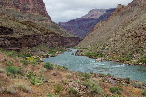
Looking downstream from Deer Creek Falls camp. |
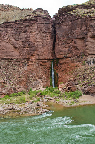
Deer Creek Falls as it gushes from the slot canyon above. Just below the falls a trail leads up and through the slot to the top of the Tapeats sandstone plateau. This is a beautiful hike as you follow backward through the course of the Deer Creek and the carved stone of its slot canyon to Deer Creek springs a little over a mile from the river. |
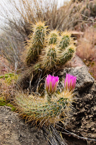
Hedgehog Cactus and their gorgeous pink blooms. |
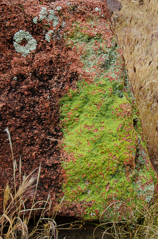
Canyon rock dressed in lichen. |
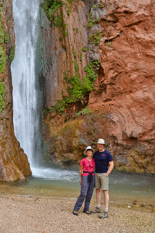
Bob and Lisa standing next to beautiful Deer Creek Falls. |
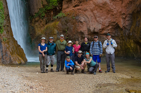
Our hiking group standing next to Deer Creek Falls before hiking a spectacular and scenic mile to Deer Creek springs. |
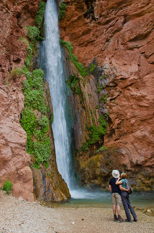
The honeymooners, Phil and Kathyrn Spargo, basking in the spray of the falls. |
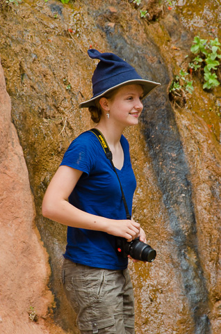
Hannah, group photographer, always ready with camera in hand. (Dad was messing with her and put his fleece hat on top of her Tilley hat.) |
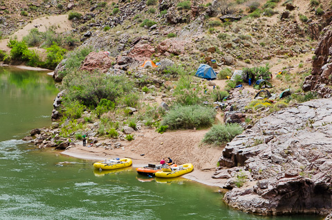
Our camp across from Deer Creek Falls where we spent another layover day. The afternoon of our arrival day was a bit windy and rainy, but the next was sunny and cool for a great day of of hiking to Deer Creek Springs. As with most camps along the way the area is rugged, but beautiful, with lots of beavertail cactus blooming in the area. |
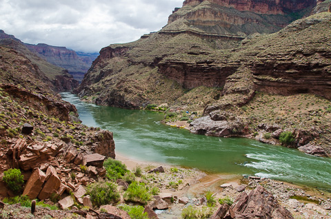
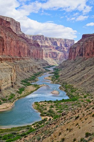
The blue-green of the Colorado river through Grand Canyon looks like and emerald ribbon making its way through the red landscape of the desert southwest. Though its name,"Colorado", means red in Spanish, it's now seldom that color because it no longer carries all the red silt it once did before Glen Canyon dam was built. Unless there's a side-canyon flash flood to recolor the river desert red, it continues on at a controlled rate, blue-green in color, and always cold from its source at the bottom of Lake Powell. |
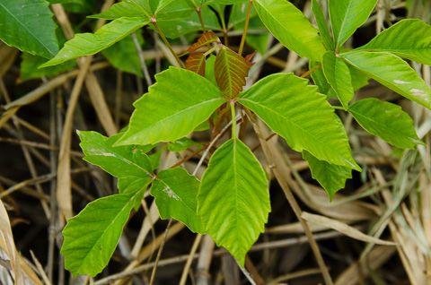
Hikers need to be careful as poison ivy abounds, especially in wet areas. |
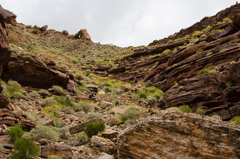
The trail up to Deer Creek springs leads up through the Tapeats sandstone formation. |
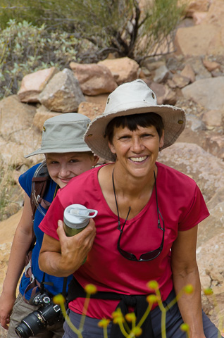
Lisa and Hannah coming up the trail -- what fun! |
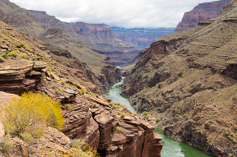
View from the top of the Tapeats formation. |
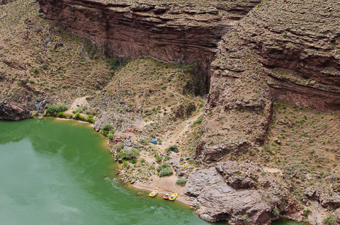
Our camp looks miniature from our view above Deer Creek falls. |
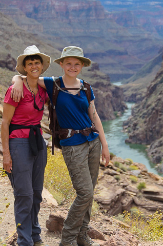
Mom and daughter where we love to be, out-of-doors and hiking. |
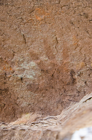
Touches of the Past. A hand print appears on the sandstone walls of the canyon above Deer Creek Falls. These memorials of the native peoples were made by placing a person's hand on the wall and blowing "white paint" on them. Over the ages, Hopi, Pai, Zuni, Apache, Anasazi and other Native American groups have lived in the Grand Canyon Region. |
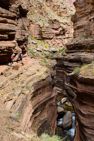
Lisa and Hannah sneaking around a tight bend in the canyon as the trail edges its way above a steep drop-off to the water of Deer Creek below. |
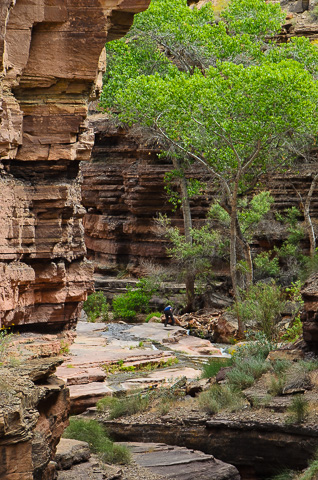
The lush plant life at the "Deer Creek Patio" shades us as we take a break and enjoy the breath taking beauty of this place. |
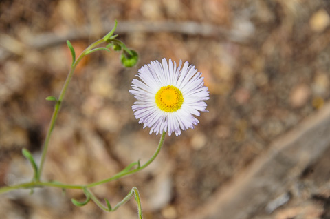
The smiling face of a purple aster looking into the camera -- another example of the amazing vegetation found in the Grand Canyon. |
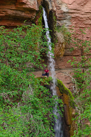
Lisa behind Deer Creek Springs as it falls out of the canyon wall. From here the water flows a little over a mile, cascades over Deer Creek Falls, and flows into the Colorado River. |
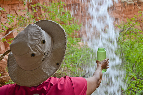
Lisa filling her water bottle in the gushing spray flowing out of Deer Creek Springs. |
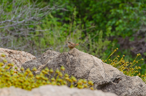
A Canyon Wren shows himself along the trail. These birds are seldom seen, but their distinctive cry of a high, clear series of descending notes; tee-tee-tee-tee-tew-tew-tew-tew is often heard as you travel though the canyons of the southwest. (Click here to listen the Canyon Wren's song.) |
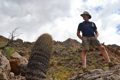
Bob and a barrel cactus are silhouetted against the sky. This trip was Bob's third trip down the Grand Canyon and his first as group leader. |
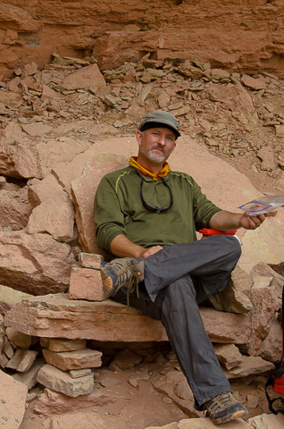
"Sir" Brunson relaxes in the Throne Room, where other visitors to the canyon have built "thrones" out of the sandstone slabs that lay scattered near Deer Creek Springs. |
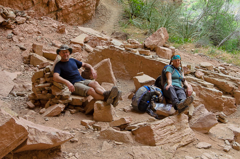
Phil and Kathryn Spargo eat their lunch and recline on some "thrones" of their own. |
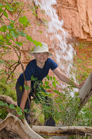
Caleb poses behind the spring. |
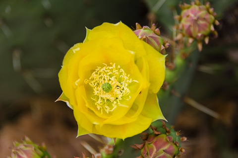
A vibrant cactus bloom after recent rains and cooler temperatures. |
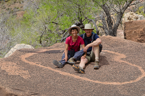
In less than a month we would be celebrating our 25th anniversary and nature provided this perfect lichen heart to remember the perfect "Potts version" of an anniversary cruise. |
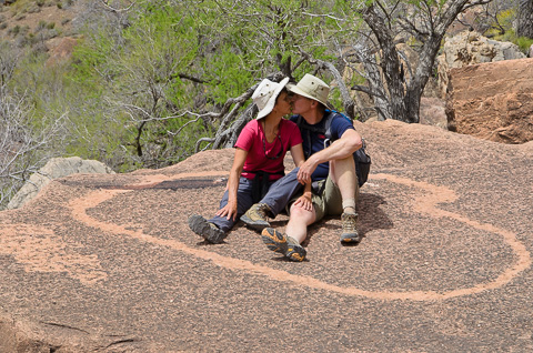
It's been a great 25 years adventuring together. |
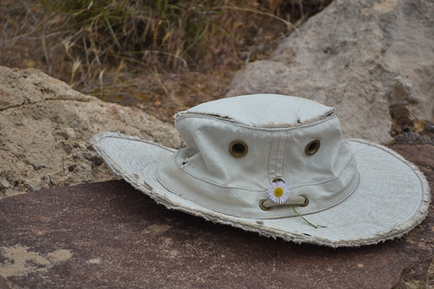
Lisa's well-used Tilley Hat resting along the trail. |

Father and son pose for a picture that will remind them for years to come of the great experience they had making this trip together. |
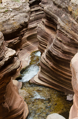
Deer Creek magically carving the sandstone walls as it makes its way to the river. |
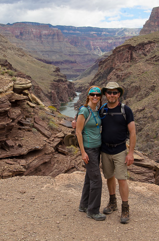
The honeymooners, Phil and Kathryn Spargo, standing in front of the fabulous vista of the Grand Canyon. |
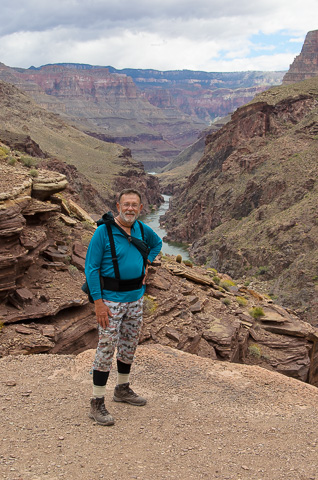
Bill Belloni, our visiting New Zealander, catches a photo op after hiking through Deer Creek Canyon. |
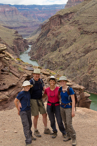
With the majestic Colorado behind, the Potts Clan smiles for the camera before heading down the the trail and back to camp. |
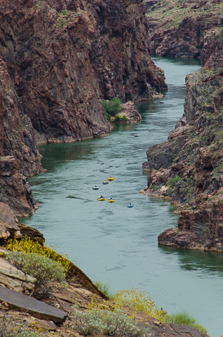
Another private group making their way through the narrowest part of the Grand Canyon. |
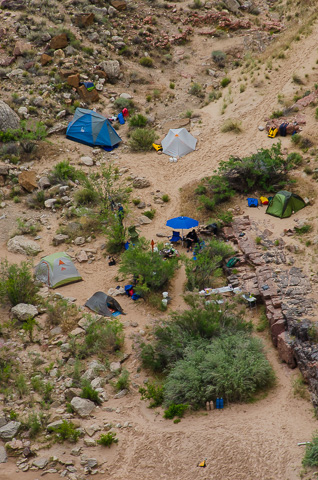
Our tent city spread out with the kitchen in the center and everyone's personal space around it. It rained the night of the 25th so everyone that had a good and snug tent was happy they did. It really pays to have good equipment on a trip like this; no one wants to wake up wet and soggy. |
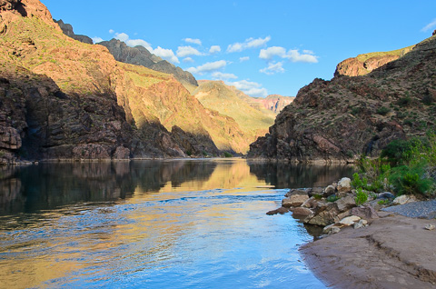
The blue sky sets off the earth-tinted canyon walls. The first Europeans to visit the canyon, conquistador Garcia Lopez de Cardenas and his small group of soldiers, did not find the canyon to be noteworthy, but its beauty has inspired generations of poets, artists, explorers, and many others to this day. |
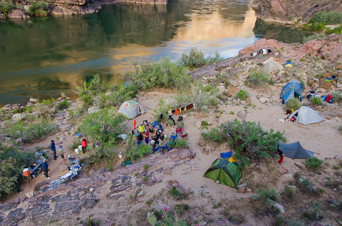
Deer Creek camp from above with the kitchen setup in the lower left and the ring of chairs around the campfire in the center. |
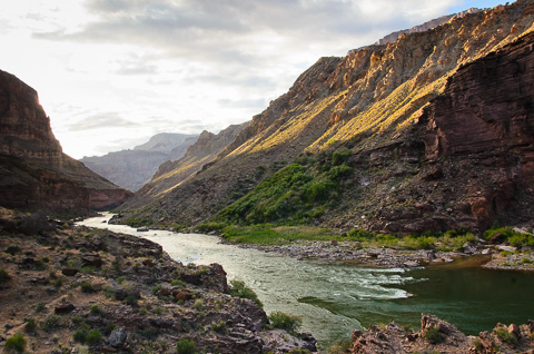
A view down river from Deer Creek falls catches the last of the fading sunlight as it lights up the canyon walls. |
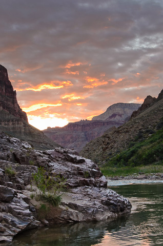
The sun sets the sky on fire as our group prepares to hit the sack or settles into their chairs around the campfire. |
|
After a really great couple of days at Deer Creek, we were headed for another great side canyon excursion, Matkatamiba Canyon. On our way there, however, we wanted to see if we could make it into Olo Canyon at river mile 146. Olo is really great too, but it is very difficult to get into without technical climbing gear or a ladder system of sorts. We stopped and checked to see if someone had left a rope so we could check it out, but no luck. We didn't want to take more time to set up a system, so we had lunch and moved on to "Matkat". |
|
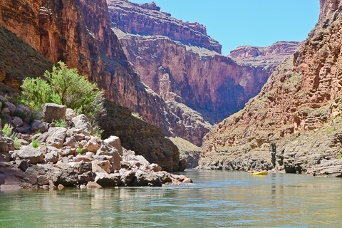
With boats on the move again the group heads down river for our next stop at Matkat. |
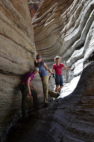
Hannah, Kathryn, and Lisa in the twisting walls of Matkat Canyon. |
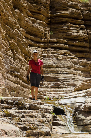
Lisa on the limestone layered folds of Matkat, the water trickling past her feet and down to the river. |
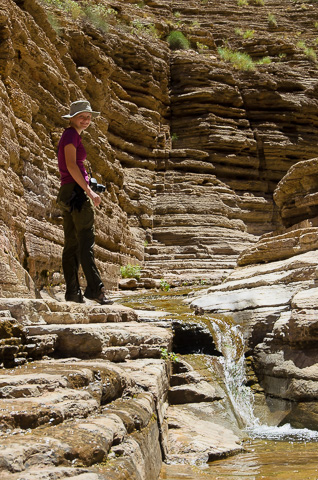
Hannah pauses for a moment to smile for the camera and check on her own camera, which almost got submerged a bit earlier in a more difficult section of Matkat. |
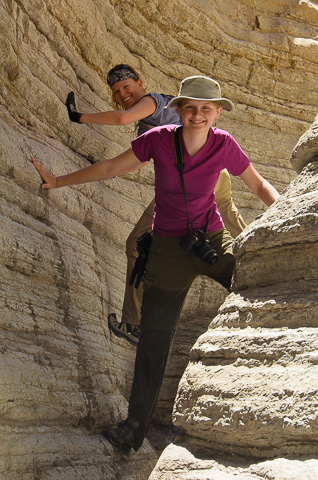
Hannah and Kathryn balance above the water flowing through Matkat with pants soaked above the knees. During this trip wet clothes were a daily occurrence. |
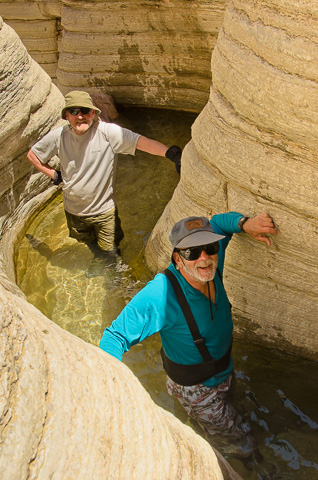
Bill and Frank looking a bit more grizzled after two weeks on the river. |
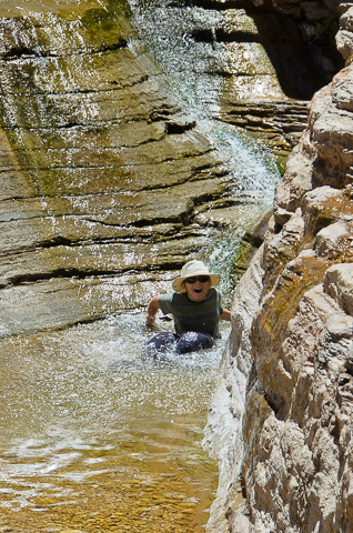
Caleb enjoying nature's water slide. |
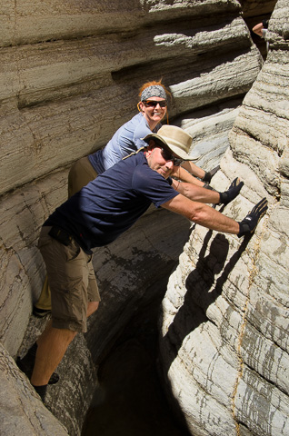
Stemming through Matkat. |
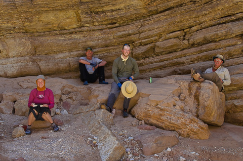
Relaxing in the shade, sipping sodas, and finishing lunch. |
|
|
About three miles below Matkat is another one of the big Grand Canyon rapids that flips a lot of boats -- Upset Rapid (8). Upset wouldn't be that bad except for the big and wide hole at the bottom which sneaks up on you; you think you've made it, and all of a sudden there it is. It pays to scout Upset so it doesn't "sneak" up on you. |
|
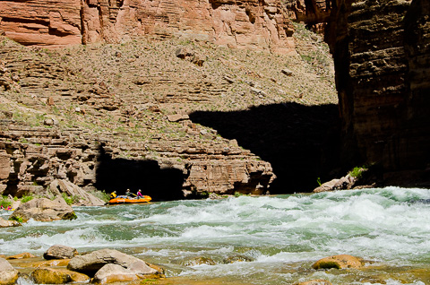
The Chubasco boat with Kameron at the oars, and Debra and Frank along for the ride, prepares to enter Upset Rapid. |
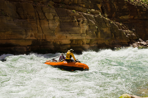
"Chubby" sliding through Upset. |
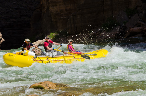
Konnor rowing his boat through Upset with Phil and Katherine aboard |
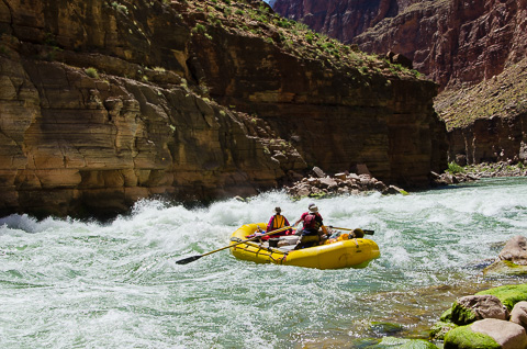
Konnor sneaking past the sleeper hole. |
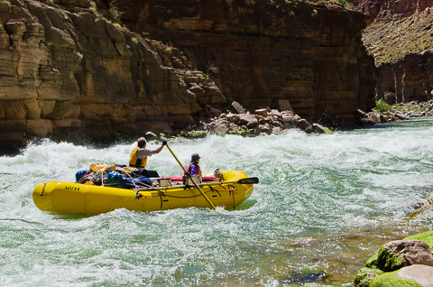
Earl and Bill onboard the boat nicknamed "Oyster" by boatman Earl as they navigate Upset rapid. |
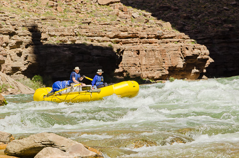
Bob and Hannah head into Upset Rapid. Lisa was able to take this series of pictures because she and Caleb didn't ride through Upset Rapid. |
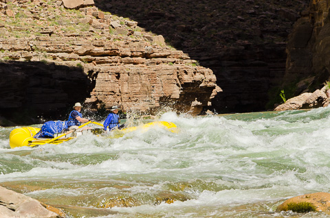
The Potts' boat, nick named "Base Camp", entering the upper waves of the rapid. |
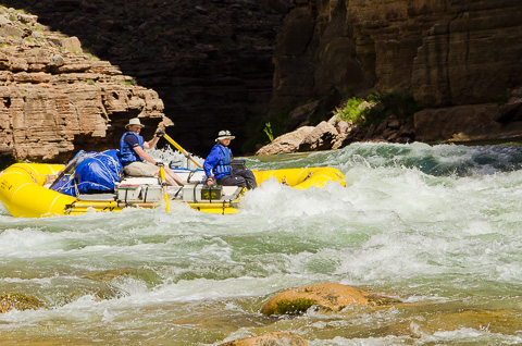
Hannah and Bob in matching blue life vests. These same life jacket were worn by Bob and Lisa when they first rafted the Grand Canyon together 12 years earlier. |
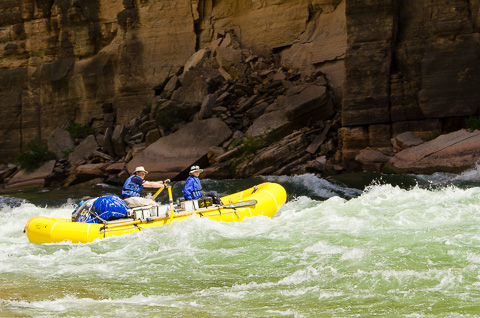
The huge pile of rubble behind our boat is the exposed portion of the collapsed cliff that has partially dammed the river and formed this rapid. |
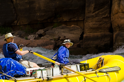
Two very different expressions: One is focused while the other is pure enjoyment. What fun! |
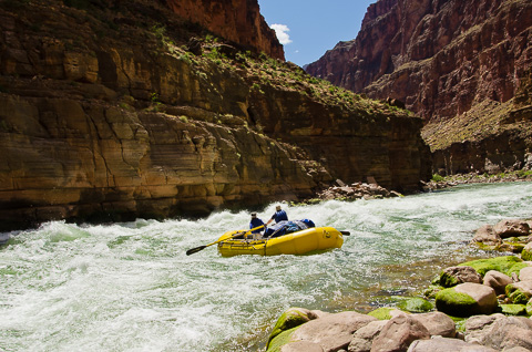
A final shot of Bob and Hannah as they cruise past Lisa the photographer. |
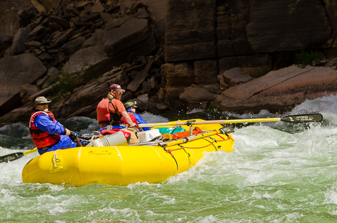
Mike Brunson, Kim Kelsey and Christian Brunson all lean back as another wall of water comes their way. |
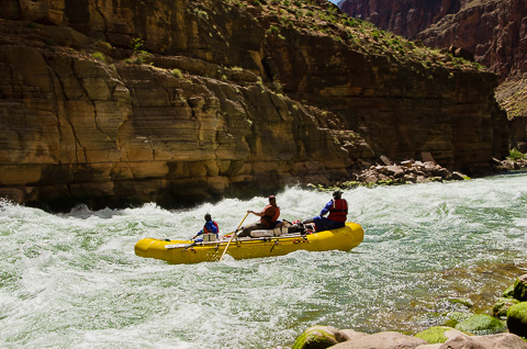
A successful run of Upset Rapid sees all our boats and passengers off to smoother water. |
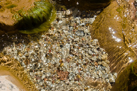
The final shot Lisa took while walking back to the boat after the run through Upset. All that turbulent water on one side with a placid pool cradling this shimmering collection of river pebbles on the other. |
April 27 -- Ledges Camp -- River Mile 153 |
|
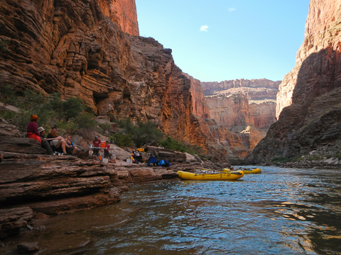
After another big day, the group was happy to relax on the rock outcroppings of the Ledges Camp while Mike serenaded us with his Indian Flute. |
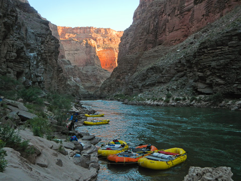
Tied to the rock ledges the boats bobbed lazily in the deep water. At most camps we had sloping sand beaches where we had to stay vigilant to changing water levels as the amount of water released from Glen Canyon dam changed. At those camps you often had to push the boats out so they didn't get beached, or pull them in so they weren't in the main current. At this camp we got a break from that regular duty. |
|
After a very enjoyable time at the Ledges Camp we had a great day in store hiking, playing and exploring Havasu Canyon. |
|
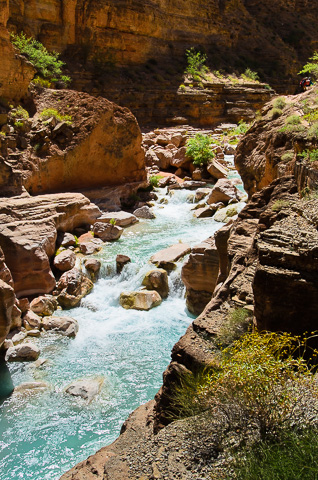
The blue-green waters of Havasu flow through the jumble of rocks and pool into warm, shallow spots for visitors to splash and relax. |
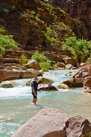
Hannah wades through the waters of Havasu Canyon, while above Konnor and Kameron carry two inflatable kayaks (Duckies) for running through the tiny waterfalls and still sections of Havasu. |
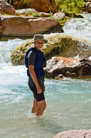
Hannah smiles beneath her Tilley Hat while the water cascades behind her. This stop was one of her favorite parts of the river trip. |
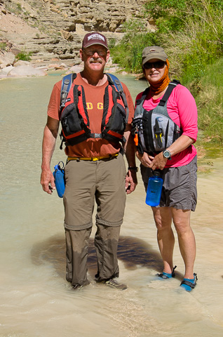
Kim Kelsey "Old Griz" and Debra March get their feet wet in the waters of Havasu. |
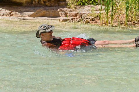
Mike Brunson having fun in Havasu as he floats down the sparkling blue waters in his "Life Diaper." |
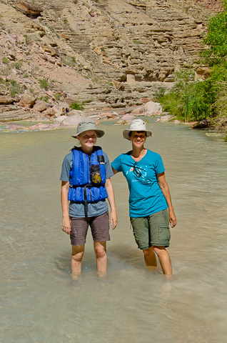
The Potts' girls hangin' out together. |
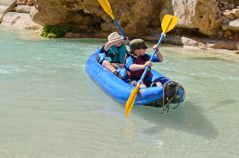
Caleb and Christian in Havasu as they float down a calm area in an inflatable kayak. |
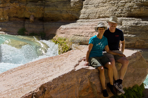
Bob and Lisa smile after completing another stage of their "Grand Adventure." |
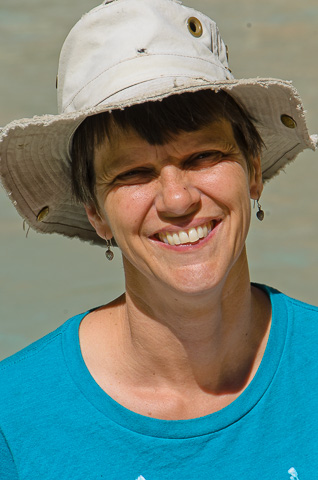
Face tanned by the sun, Lisa smiles at the camera. |
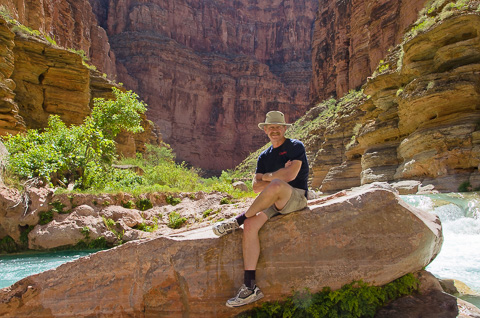
Bob, our adventuring man, enjoys his third visit to Havasu. Though the group didn't hike all the way to the big falls upstream (Beaver, Mooney and Havasu), they enjoyed splashing through the brilliant blue waters. |
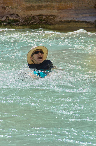
Caleb laughs out loud as he floats down Havasu. |
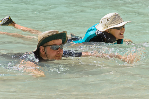
Phil and Caleb float downstream in their life vests. Caleb really enjoyed swimming along in the water and bouncing down the waterfalls. |
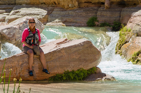
Debra, on one of her many trips down the Grand Canyon, stops to enjoy the splendor of another. |
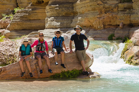
Caleb, Debra, Lisa and Phil all decked out in their river garb. |
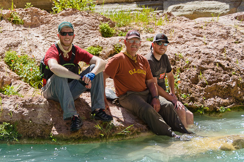
The Kelsey's, who own the Nine Quarter Circle Ranch in Montana, pause for a family photo. They plan to keep adventuring in the Canyon through the years to come. |
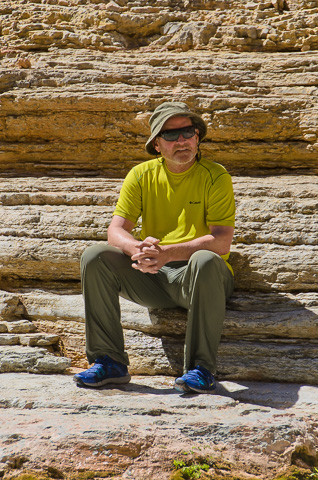
Frank relaxes on the shore of Havasu as he hangs out with his bikini babes (not pictured here). :) |
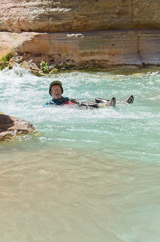
Bill enjoying the joy of Havasu as he floats down in his "Life Diaper". |
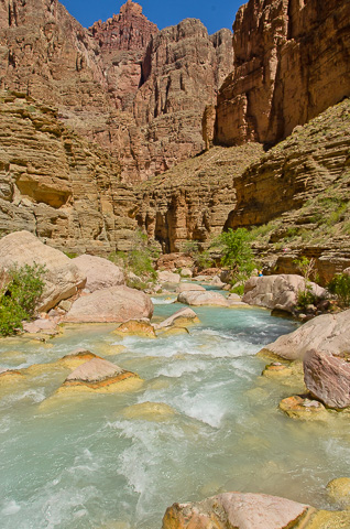
The beautiful rapids of Havasu Creek. |
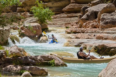
Kameron and Konnor as they navigate Havasu all the way to the river. |
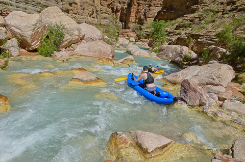
Konnor and Kameron threading their way through the rocky rapids of Havasu. |
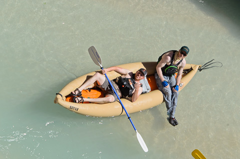
Konnor and Kameron hanging out in their Ducky. |
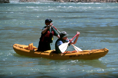
Konnor and Kameron a few years earlier on our 2001 Grand Canyon River Trip. |
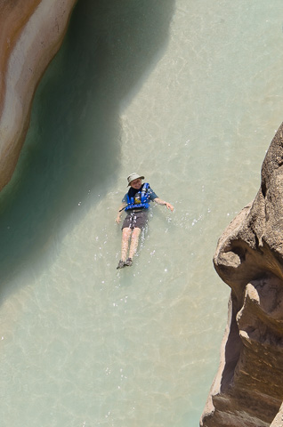
From the cliff above Bob caught this picture of Hannah peacefully floating down Havasu. |
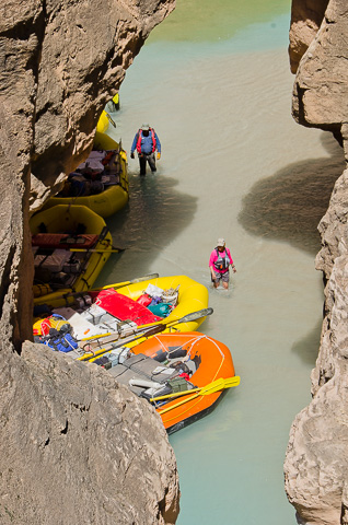
The group getting ready to leave Havasu, even though no one wanted to. |
|
After a great time in Havasu we got to business making up some miles. Our goal was to position ourselves to deal with Lava Falls Rapid (9) sometime mid-moring April 29th. The river moves pretty fast through this section without a lot of side attractions so it was a good time to sit back, enjoy the sun, and river time. It was enjoyable as we floated past Tuckup Canyon, ran a couple small rapids like National and Fern Glen, passed by Stairway Canyon and found a great camp the night of the 28th at the mouth of Mohawk Canyon. |
|
April 28 -- Mohawk Camp -- River Mile 172 |
|
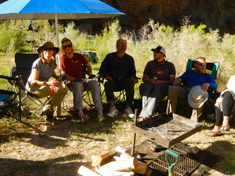
The group relaxes in the shade after a day of rowing, swimming, and setting up camp. |
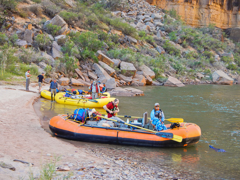
Loading the boats and checking life vests before launching from the Mohawk camp. |
|
Much of the conversation the morning of April 29th was all about our big day in Lava. It was a perfect day for it as the weather was warm, but not too hot and the Mohawk camp was really quite and made for a great nights sleep. As was usual for our group we launched right around 8:00 a.m. which set us up perfectly for a mid-morning run through Lava. |
|
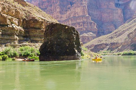
Vulcan's Anvil. Once you get here, you know you've only about a mile above the biggest rapid in the Canyon, Lava Falls (9). |
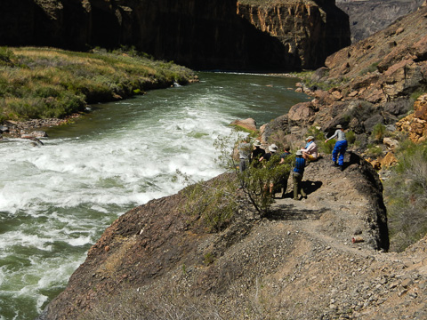
Everyone lining up to scout Lava Falls rapid. |
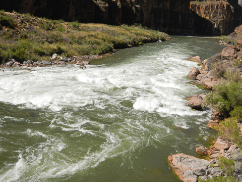
Sure a lot going on in there. In the middle left of the picture is the famous "Ledge Hole" and way below on river right is the the equally famous "Cheese Grater" rock. There's a bit of "green" just right of the Ledge Hole which is where we made our runs. Below that however is a fairly big hole the builds and builds on itself until it collapses. Going into that sideways at the wrong time would guarantee a flip. |
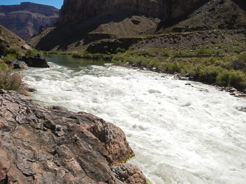
Fortunately we all made it safely though. This picture was taken from above "Cheese Grater." |
|
Here is another video that Katherine Spargo took of our entire group running Lava Falls Rapid. |
This is the Potts Family's run through Lava where Bob nearly got "swept" from his boat when they hit the hole below the "green" line mentioned above. It's amazing how little control you have of your boat in big water; it's all about the set up before going into a rapid, keeping your boat straight, and hoping to hit the big holes and waves at just the right time. |
|
After all the excitement of running Lava things slowed down quite a bit as we floated another eight miles through the very old Toroweap lava flows. On the way we ran a couple of smaller rapids including Lower Lava Rapid (4) and Hundred and Eightyfive Mile Rapid (2) before our next camp at Whitmore Wash. |
|
April 29 -- Whitmore Wash -- River Mile 188 |
|
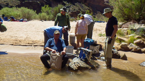
Bob and a few others get the water purifier set up. |
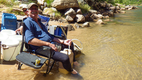
Earl relaxes as he filters water. |
|
After leaving Whitmore Wash the morning of April 30th we focused on making up about 20 miles to Indian Canyon at river mile 207. This stretch of the river flows fairly quickly past the Hualapai Indian Reservation on river left, but we did take a couple of breaks including a short walk up Parashant Canyon to check out the "Book of Worms" at river mile 199 to see the fossilized collection of worm burrows. Mid-afternoon we ran the only really big rapid of the day, Two Hundred and Fivemile (Kolb) Rapid (6) before getting into camp for the night. |
|
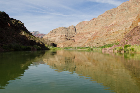
A quick look behind reminded us of the 200+ miles of amazing beauty we had traveled through. |
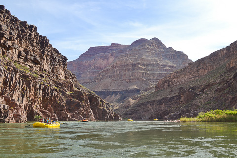
The canyon wall put into perspective by the miniature rafts. |
April 30 -- Indian Canyon -- River Mile 207 |
|
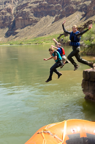
Hannah, Christian, and Caleb simo-jumping off a big rock next to camp. |
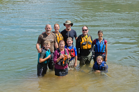
Standing on a submerged rock after jumping, swimming, and cooling off in the river. |
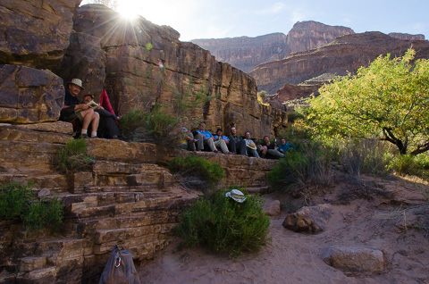
Relaxing and sipping beers in the cliff shade at Indian Canyon camp. |
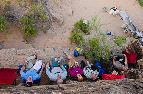
The "beer sippers" |
|
After a really great time at Indian Canyon, we packed up once more to enjoy the last full day we would have on the river with the goal of positioning ourselves close to Diamond Creek where would be picked up by PRO for our return to civilization. Along the way we had a couple of rapids to run including Two Hundred and Ninemile Rapid (5) and Little Bastard Rapid (3). About five miles below Two Hundred and Ninemile Rapid is Pumpkin Springs and just beyond that we found some great cliffs with deep water below for a little cliff jumping. |
|
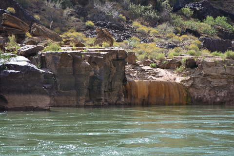
Pumpkin Spring; a warm, fetid, and utterly uninviting pool of water that has high concentrations of arsenic. We just floated on by... |
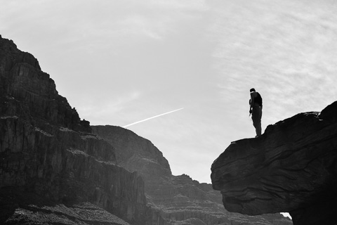
A few brave souls in our group took the plunge from one of the 30-foot cliffs below Pumpkin Springs. Kameron, Phil, Konor, Christian, and Mike all made the leap. |
May 1 -- Two Hundred and Twenty Mile Camp -- River Mile 220 |
|
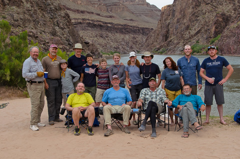
Our amazing 2015 Grand Canyon river trip group after their last full day on the river. |
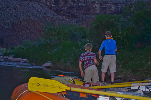
Caleb and Christian as they trying to catch one of the many fish they could see schooling around the boats. |
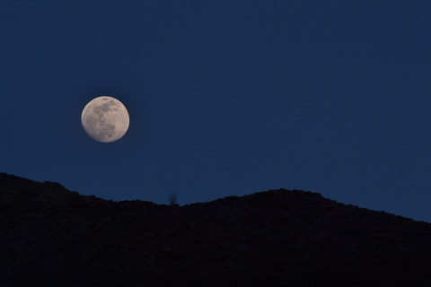
A beautiful nearly-full moon graces us on our last night on the river. |
|
|
The morning of May 2nd was a bit sad for us as we had to pack our boats for the last time before floating a short five miles to the takeout at Diamond Creek. By this time we really had the routine down and were on the river by 8:00. Part of the reason we had to get going was to get the old orange Chubasco boat downstream for it's final float. After 30+ years, the Chubasco was falling apart and we were having a difficult time keeping it inflated. In fact, on this last day we distributed its load to the other four boats and Konnor and Kameron nursed it to the takeout. |
|
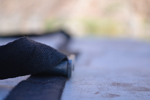
A close-up of one of the many straps that held our gear in place. With the possibility of flipping a boat always looming, it was important that gear was always secure. |
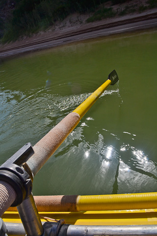
One of the Potts' oars making another dip into the river after bringing their boat almost 226 miles from Lees Ferry. |
May 2nd -- Diamond Creek -- River Mile 225 |
|
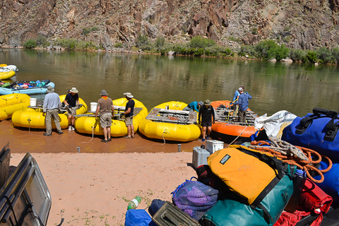
Unloading and de-rigging boats at Diamond Creek. |
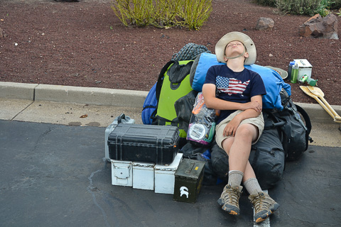
Caleb "crashed" on the gear after a long day of work and travel back to Flagstaff. |
|
After making it back to civilization and enjoying warm showers and a real bed, we took the long way home to have a view of where we had been from the South Rim of the Grand Canyon. It was really great to see where we had been, but was also a bit overwhelming to be around so many people after almost three weeks of Canyon solitude. |
|
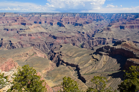
A gorgeous view of the canyon from the South Rim. |
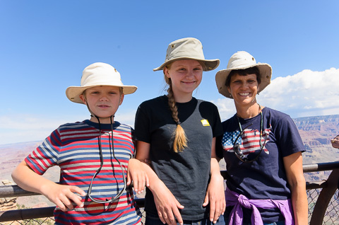
Caleb, Hannah, and Lisa enjoying the view of the canyon from the south rim. |
|
A couple of weeks after returning from our "Grand" adventure, we had the Nevada contingent come over to touch base, reminisce, and share pictures. It was really great seeing everyone. We will cherish the new and lasting friendships formed during this adventure. What a great trip! |
|
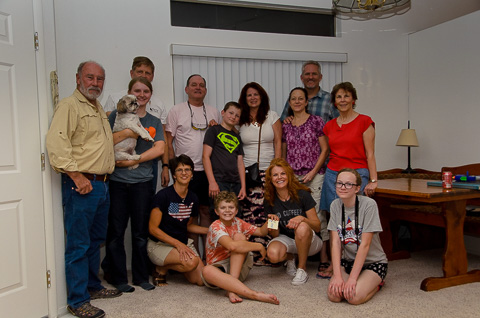
The Nevada group and some family members that didn't go on the trip pose in the Potts' house. Standing from left are: Alex Heindl, Hannah Potts with Christy (our dog), Bob Potts, Frank Nason, Christian Brunson, Debra March, Wendy Brunson, Mike Brunson, and Erin Nason. Below are Lisa Potts, Caleb Potts (with sticky note representing the missing Phil Spargo), Kathryn Spargo, and Lily Brunson. Our 2015 river trip through the Grand Canyon was really great. Even though it was a lot of work, the experience and friendships made it completely worthwhile. |
|