
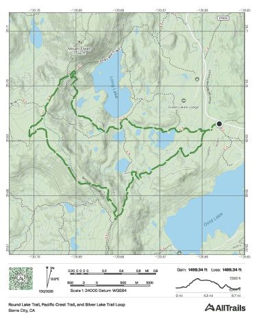
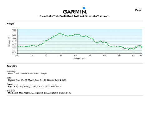
Bob, Len Savage and Mike Kazmierski at the start of their 8.7 mile hike in the beautiful Lost Sierra region of the Sierra Nevada mountain range.
Bob met Mike and Len when he was working at the Governor's Office of Economic Development and Mike was the president and CEO of the Economic Development Authority of Western Nevada (EDAWN) and Len was Chairman of the board.
Even though the three of us no longer work together, we all share a love of the outdoors and often talked about hiking together. This was the first hike of hopefully many to come with thanks to Len for setting this one up. Great to be together in hiking shorts rather than suits.

Mike and Len at the first stop on our trip, Round Lake and what's left of the abandoned Round Lake Mine.

Bob and Mike about 2.5 miles into the hike where the Round Lake trail meets up with the Pacific Crest Trail. The elevation here was about 7,300 feet and a 700 foot gain from our starting elevation of 6,600 feet.

The Pacific Crest Trail marker holding on the last piece of bark of this tree that no longer survives timberline.

Hiking down the Pacific Crest Trail portion of our wonderful loop hike with Long Lake in the distance. This was a very enjoyable two mile section of our hike that meandered through thick pine, had great views and we got to visit with eight or so through-hikers who were now nearly halfway on their 2,650 mile hike from Mexico to Canada on the Pacific Crest Trail. It was great!

Len and Mike enjoying the incredible views from the Pacific Crest Trail with the Sierra Buttes in the background.

Len took this picture of Bob looking west across the beautiful Lost Sierra region of the Sierra Nevada's to the Sacramento Valley.

What a great way to spend a Friday; hiking trails like these with friends like Len and Mike.

About five miles into our hike with views of Mount Elwell (7,818 feet) and Long Lake.
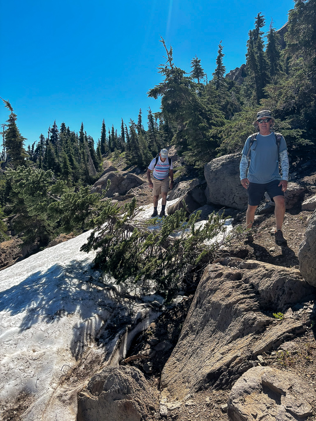
Len and Mike negotiating the only snow bank we had to cross. It was good to see there was still a decent amount of snow in some of the shaded canyons below the ridge we were hiking on.
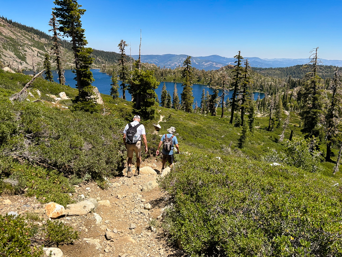
Heading down the trail with Long Lake in front of us.
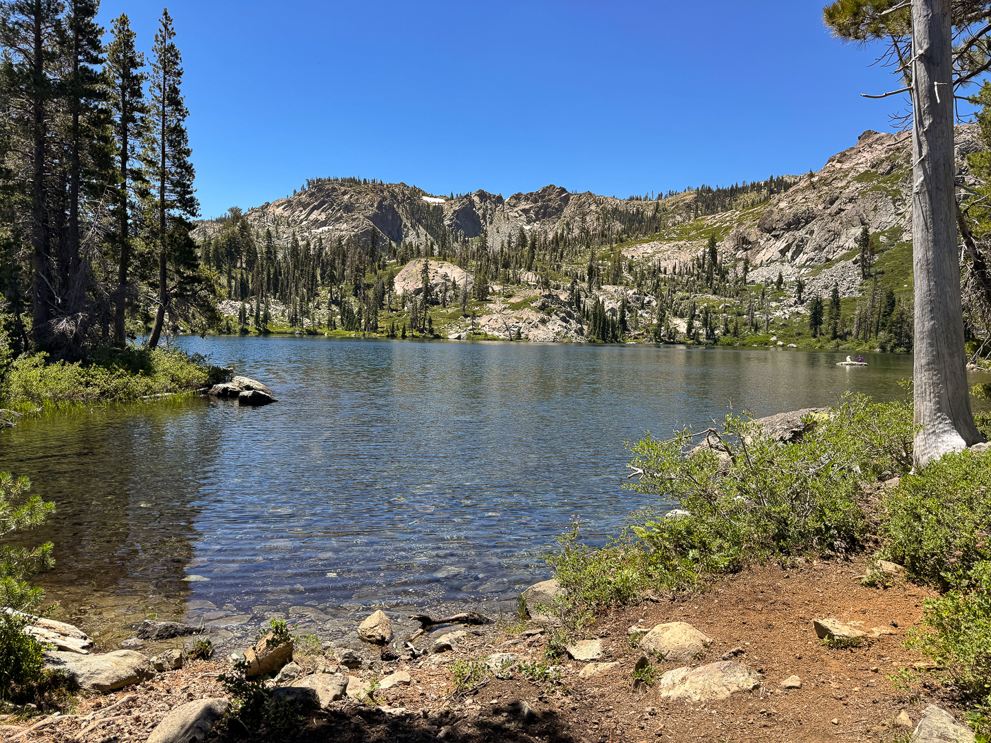
At the banks of Silver Lake. This is where we began the Silver Lake trail section of our loop hike. At this point we were about seven miles into our hike at an elevation of 6,700 feet.

The three of us just past Silver Lake with Long Lake and Mount Elwell (7,818 feet) beyond.
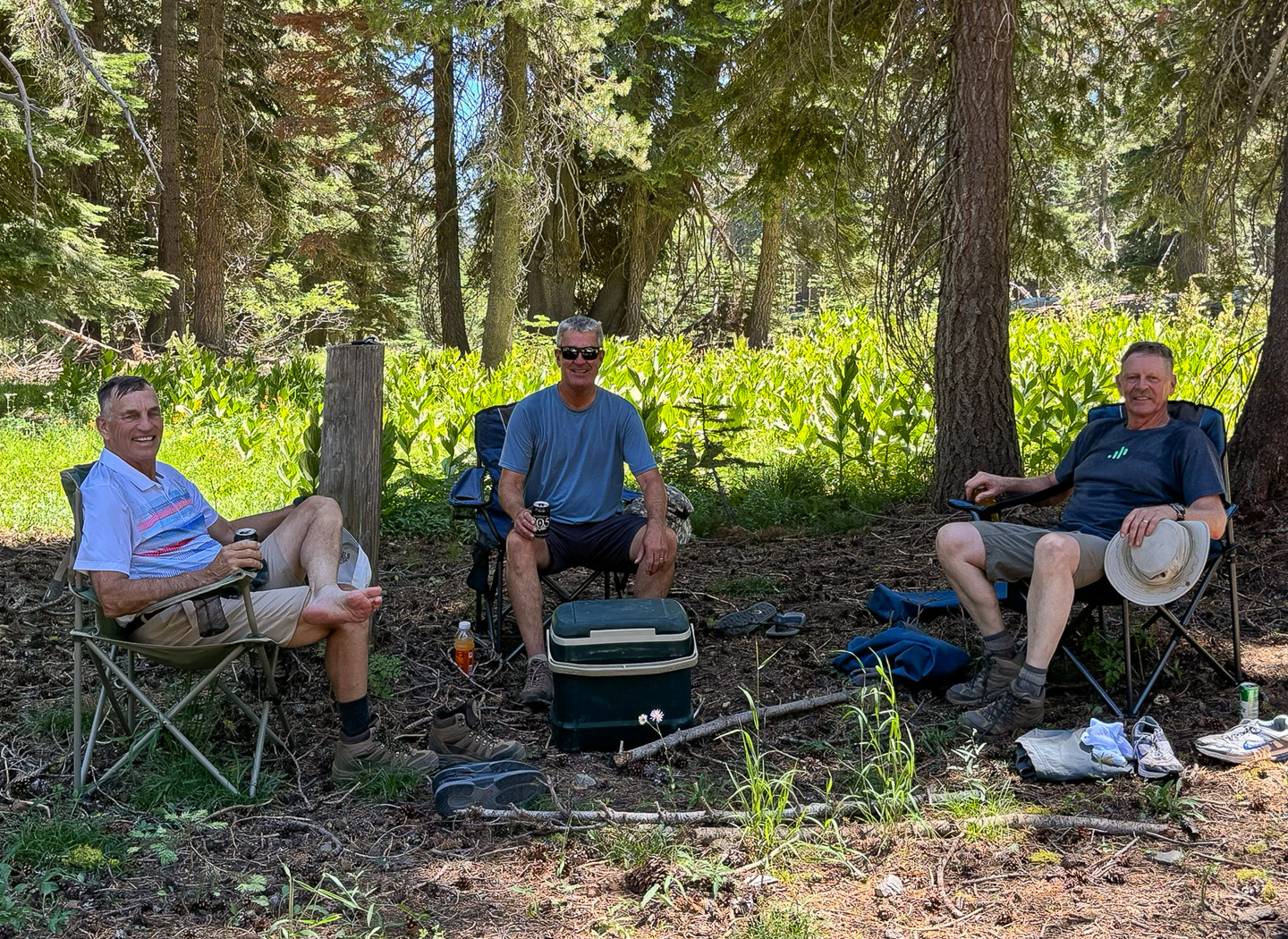
Len was such a rock star; not only did he set up this hike, he drove us there, and then had chairs and cold beer for us to enjoy in the shade when we got done. What a guy...
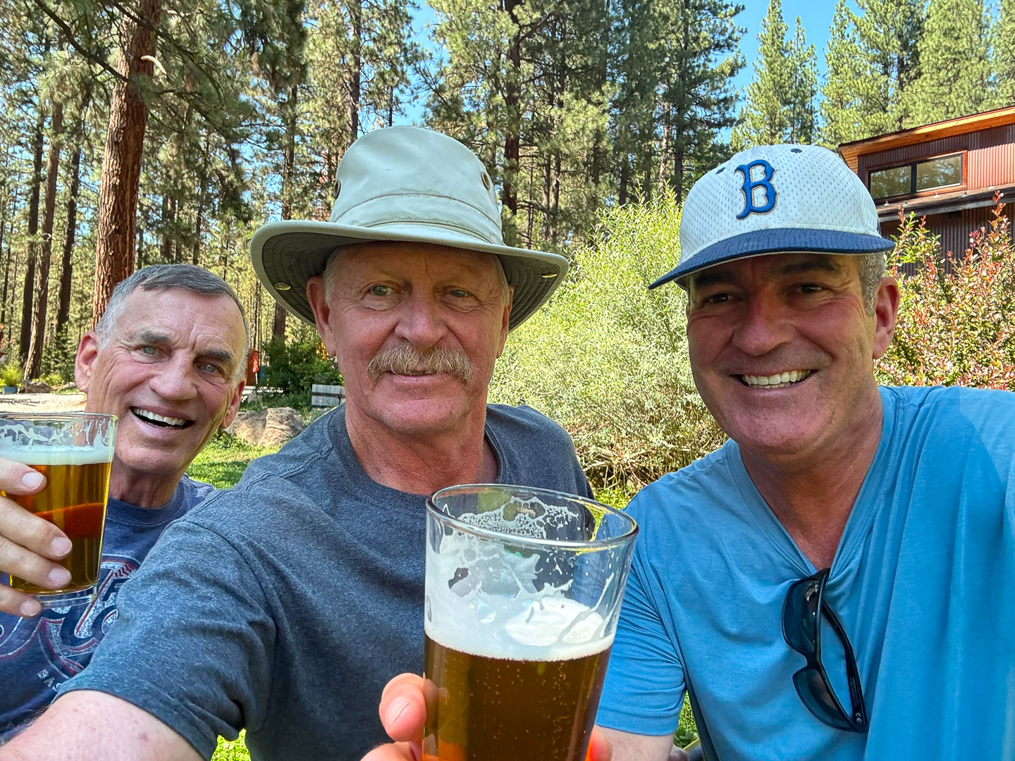
Then, as were headed home and about 10 miles down the road, Len pulls in to this amazing microbrewery just outside of Blairsden called The Brewing Lair where we enjoyed Ambush IPA's and told stories. True to form, Len not only bought a round, he also bought both Mike and I a Growler to go.
Friends don't get any better than that!